mail_outline sales@mediastorehouse.com
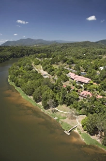
Barron River, Kuranda Railway Station and Skyrail Terminal, near Cairns, North Queensland, Australia - aerial
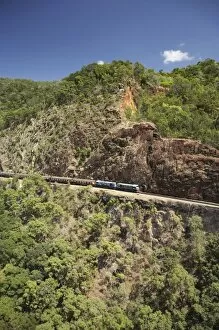
Kuranda Scenic Railway at Red Bluff, Cairns, North Queensland, Australia - aerial
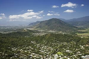
Freshwater, Cairns, North Queensland, Australia - aerial
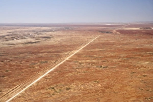
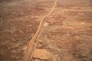
Oodnadatta Track, and Old Ghan Train Line, near William Creek, Outback, South Australia, Australia - aerial
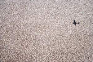
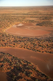
Shadow of Plane on Lake Eyre Salt Lake (15m below sea level), Lake Eyre National Park, Outback, South Australia, Australia - aerial
Desert Track near William Creek, Outback, South Australia, Australia - aerial
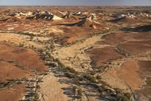
Painted Hills, near William Creek, Outback, South Australia, Australia - aerial
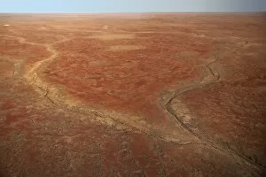
Dry River Bed near William Creek, Outback, South Australia, Australia - aerial
Dry Lakes near William Creek, Outback, South Australia, Australia - aerial
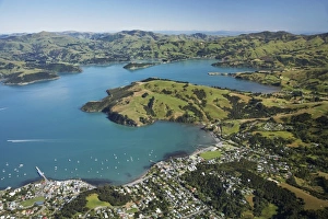
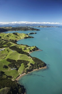
Akaroa, Akaroa Harbour, Banks Peninsula, Canterbury, South Island, New Zealand- aerial
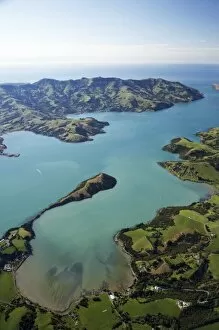
Akaroa Harbour, Banks Peninsula, Canterbury, South Island, New Zealand- aerial
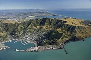
Port of Lyttelton, Lyttelton Harbour, Canterbury, South Island, New Zealand- aerial
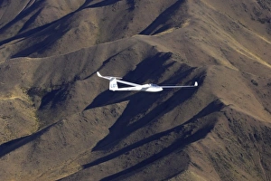
Sebastian Kawa (Poland - ranked world number one), racing in NZ Gliding Grand Prix, Benmore Range, near Omarama, South Island, New Zealand
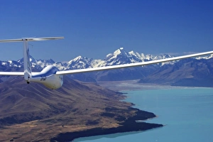
Glider, Lake Pukaki and Aoraki / Mt Cook, Mackenzie Country, South Island, New Zealand
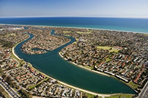
West Lakes, Adelaide, South Australia, Australia - aerial
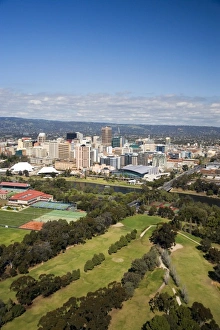
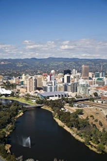
Golf Course, River Torrens and Central Business District, Adelaide, South Australia, Australia - aerial
River Torrens and Central Business District, Adelaide, South Australia, Australia - aerial
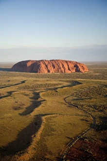
Late Afternoon Light on Uluru / Ayers Rock, Uluru - Kata Tjuta National Park, World Heritage Area, Northern Territory, Australia - aerial
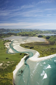
Hoopers Inlet and Allans Beach, Otago Peninsula, Dunedin, South Island, New Zealand - aerial
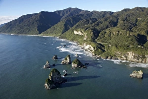
Twelve Mile Bluff and Motukiekie Rocks, north of Greymouth, West Coast, South Island, New Zealand - aerial
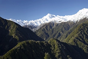
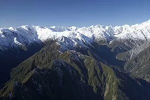
Forest and Southern Alps nesr Franz Josef Glacier, West Coast, South Island, New Zealand - aerial
Forest Burster Range (centre) and Southern Alps nesr Franz Josef Glacier, West Coast, South Island, New Zealand - aerial
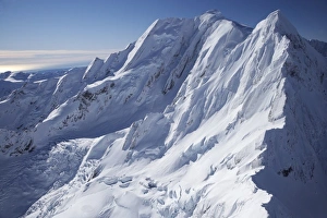
Mt Elie de Beaumont, West Coast, South Island, New Zealand - aerial
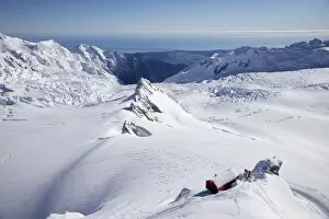
Centennial Hut, above Franz Josef Glacier, West Coast, South Island, New Zealand - aerial
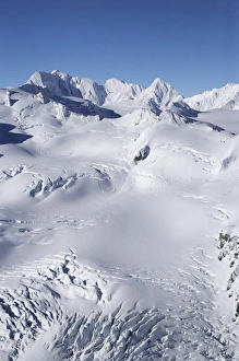
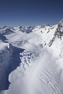
Salisbury Snowfield and Newton Rocks, above Franz Josef Glacier, West Coast, South Island, New Zealand - aerial
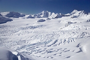
Franz Josef Glacier Neve, West Coast, South Island, New Zealand - aerial
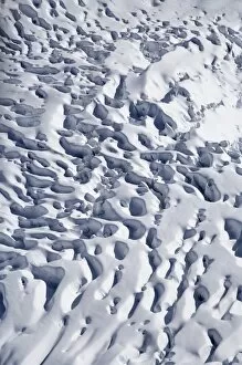
Crevasses, Franz Josef Glacier, West Coast, South Island, New Zealand - aerial
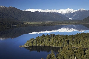
Kayakers, Lake Mapourika, and Southern Alps, West Coast, South Island, New Zealand - aerial
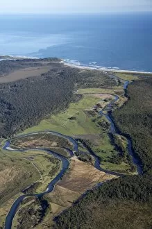
Waitangitaona River, near Whataroa, West Coast, South Island, New Zealand - aerial
Tasman Glacier, Aoraki / Mt Cook National Park, South Island, New Zealand - aerial
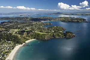
Waiheke Island, Auckland, North Island, New Zealand - Aerial
Palm Beach, Waiheke Island, Auckland, North Island, New Zealand - Aerial
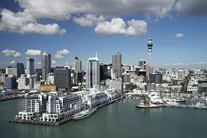
Hilton Hotel, Princes Wharf, Auckland Central Business District and Sky Tower, North Island, New Zealand - Aerial
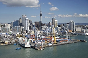
Ports of Auckland, Central Business District and Sky Tower, North Island, New Zealand - Aerial
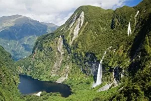
Campbells Kingdom, Doubtful Sound, Fiordland National Park, South Island, New Zealand - aerial
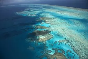
Arlington Reef, Great Barrier Reef Marine Park, North Queensland, Australia - aerial