mail_outline sales@mediastorehouse.com
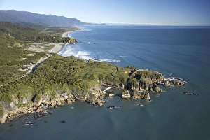
Pancake Rocks, Punakaiki, Paparoa National Park, West Coast, South Island, New Zealand - aerial
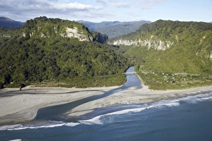
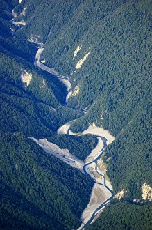
Pororari River Gorge, Punakaiki, Paparoa National Park, West Coast, South Island, New Zealand - aerial
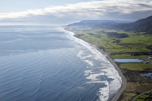
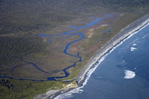
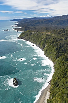
Pakiroa Beach, near Punakaiki, West Coast, South Island, New Zealand - aerial
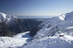
Almer Hut, above Franz Josef Glacier, West Coast, South Island, New Zealand - aerial
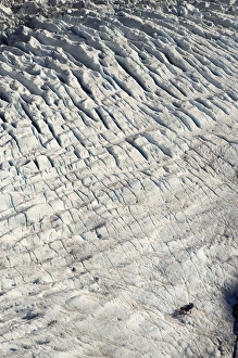
Group of Guided Glacier Walkers and Crevasses, Franz Josef Glacier, West Coast, South Island, New Zealand - aerial
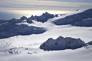
Chamberlin Snowfield and Mackay Rocks, above Franz Josef Glacier, West Coast, South Island, New Zealand - aerial
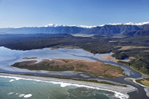
Okarito Lagoon, West Coast, South Island, New Zealand - aerial
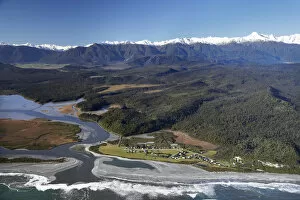
Waiho River near Franz Josef Glacier, West Coast, South Island, New Zealand - aerial
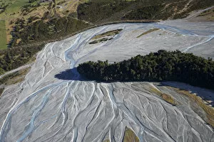
Five Mile Lagoon, near Franz Josef Glacier, West Coast, South Island, New Zealand - aerial
Okarito and Okarito Lagoon, West Coast, South Island, New Zealand - aerial
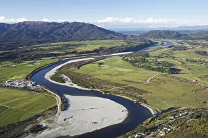
Grey River near Greymouth, West Coast, South Island, New Zealand - aerial
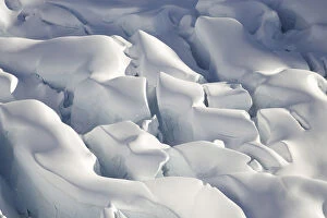
Crevasses, Tasman Glacier, Aoraki / Mt Cook National Park, South Island, New Zealand - aerial
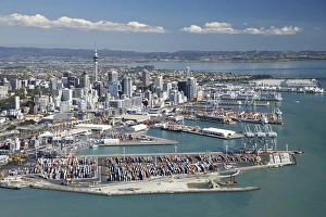
Ports of Auckland and Central Business District, , North Island, New Zealand - Aerial
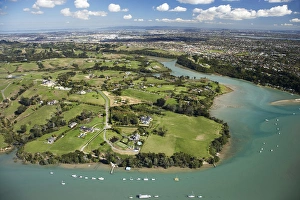
Mangemangeroa Creek, Auckland, North Island, New Zealand - Aerial
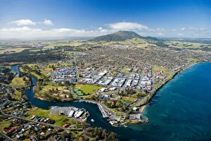
Taupo, Lake Taupo and Waikato River, North Island, New Zealand - aerial
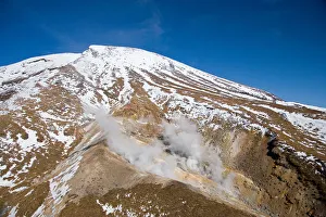
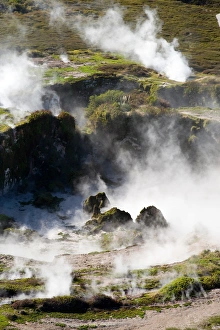
Ketetahi Hot Springs, Tongariro Crossing Track, Mt Tongariro, Tongariro National Park, Central Plateau, North Island, New Zealand - aerial
Waikato River and Lake Taupo, Taupo, North Island, New Zealand - aerial
Craters of the Moon Thermal Area, near Taupo, North Island, New Zealand - aerial
Crater on top of Mt Ngauruhoe, Tongariro National Park, Central Plateau, North Island, New Zealand - aerial
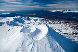
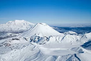
Crater on top of Mt Ngauruhoe, and Mt Ruapehu in distance, Tongariro National Park, Central Plateau, North Island, New Zealand - aerial
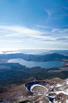
Lower Tama Lake and Mt Ruapehu, Tongariro National Park, Central Plateau, North Island, New Zealand - aerial
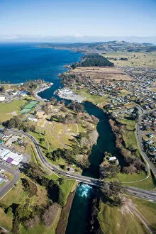
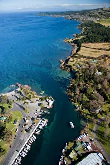
Marina at Source of Waikato River, by Lake Taupo, Taupo, North island, New Zealand - aerial
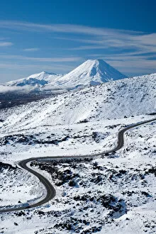
Bruce Road up Mt Ruapehu, and Mt Ngauruhoe, Tongariro National Park, Central Plateau, North Island, New Zealand - aerial
Blue Lake (frozen), Mt Tongariro (right), Mt Ngauruhoe (middle), and Mt Ruapehu (far left), Tongariro National Park, Central Plateau, North Island, New Zealand, aerial
Ketetahi Hut, Tongariro Crossing Track, Mt Tongariro, Tongariro National Park, Central Plateau, North Island, New Zealand - aerial
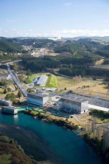
Wairakei Geothermal Power Station and Waikato River, near Taupo, North Island, New Zealand
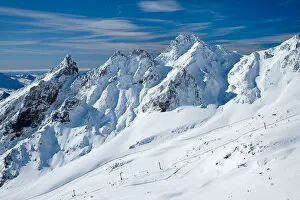
Whakapapa Skifield on Mt Ruapehu, Tongariro National Park, Central Plateau, North Island, New Zealand - aerial
Whakapapa Skifield on Mt Ruapehu, and Mt Ngauruhoe (distance) Tongariro National Park, Central Plateau, North Island, New Zealand - aerial
Sulphur Lagoon Crater on Mt Tongariro, Tongariro National Park, Lake Rotoaira, and Lake Taupo (bottom to top), Central Plateau, North Island, New Zealand, aerial
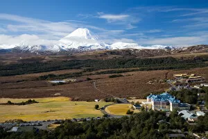
Mt Ngauruhoe and Grand Chateau, Tongariro National Park, Central Plateau, North Island, New Zealand - aerial
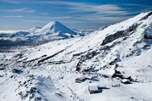
Turoa Skifield, Mt Ruapehu, Tongariro National Park, Central Plateau, North Island, New Zealand (and Mt Taranaki / Egmont in distance) - aerial
Lower Tama Lake and Mt Ruapehu (far left in distance), Tongariro National Park, Central Plateau, North Island, New Zealand - aerial
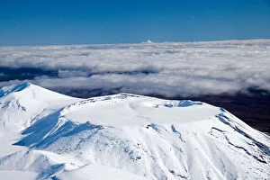
Tongariro Crossing Track (right, by shadow), Mt Ngauruhoe, Tongariro National Park, Central Plateau, North Island, New Zealand (and Mt Taranaki / Egmont in distance), aerial
Mt Tongariro, Tongariro National Park, Central Plateau, North Island, New Zealand (and Mt Taranaki / Egmont in distance) - aerial
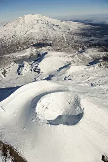
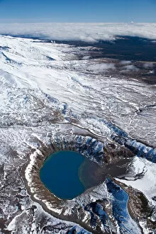
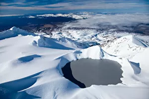
Crater Lake, Mt Ruapehu, Tongariro National Park, Central Plateau, North Island, New Zealand - aerial
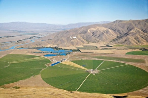
Giant Rotary Irrigation Scheme near Twizel, Mackenzie Country, South Island, New Zealand
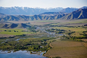
Lake Benmore and Ahuriri River, Waitaki Valley, North Otago, South Island, New Zealand - aerial
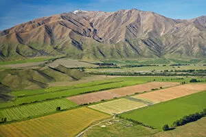
Irrigated Farmland and Benmore Range, near Omarama, Waitaki Valley, North Otago, South Island, New Zealand
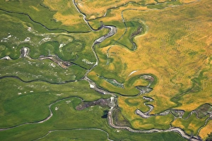
Farmland and meandering streams, near Omarama, North Otago, South Island, New Zealand - aerial
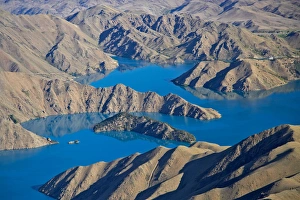
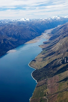
Lake Benmore, Waitaki Valley, North Otago, South Island, New Zealand - aerial
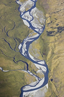
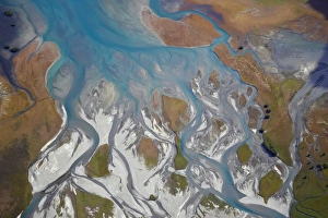
Ahuriri Valley, North Otago, South Island, New Zealand - aerial
Dingle Burn, near Lake Hawea, South Island, New Zealand - aerial
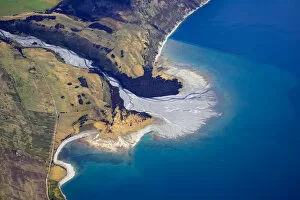
Knights Point, West Coast, South Island, New Zealand - aerial
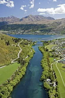
Kawarau River leaving Lake Wakatipu at Frankton, near Queenstown, South Island, New Zealand - aerial
Lake Hawea and Hunter Valley, South Island, New Zealand - aerial
Hunter River and Lake Hawea, South Island, New Zealand - aerial
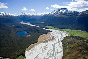
Dart River, near Glenorchy, South Island, New Zealand - aerial
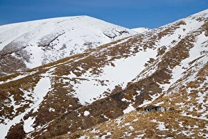
Dingle Burn entering Lake Hawea, South Island, New Zealand - aerial