mail_outline sales@mediastorehouse.com
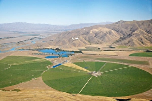
Giant Rotary Irrigation Scheme near Twizel, Mackenzie Country, South Island, New Zealand
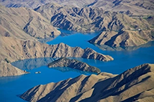
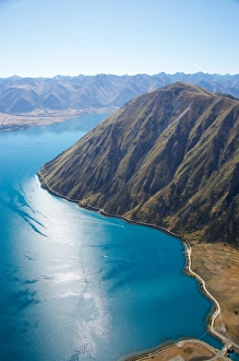
Lake Benmore and Ahuriri River, Waitaki Valley, North Otago, South Island, New Zealand - aerial
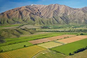
Irrigated Farmland and Benmore Range, near Omarama, Waitaki Valley, North Otago, South Island, New Zealand
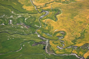
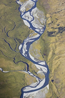
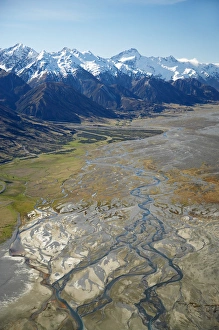
Farmland and meandering streams, near Omarama, North Otago, South Island, New Zealand - aerial
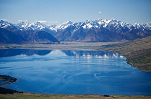
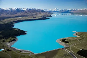
Lake Benmore, Waitaki Valley, North Otago, South Island, New Zealand - aerial
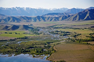
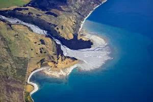
Ahuriri Valley, North Otago, South Island, New Zealand - aerial
Dingle Burn, near Lake Hawea, South Island, New Zealand - aerial
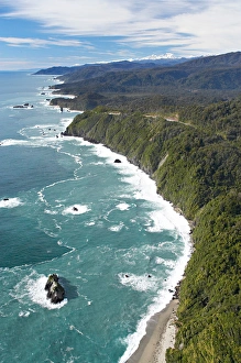
Knights Point, West Coast, South Island, New Zealand - aerial
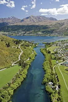
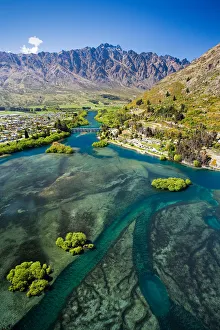
Kawarau River leaving Lake Wakatipu at Frankton, near Queenstown, South Island, New Zealand - aerial
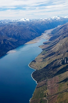
Lake Hawea and Hunter Valley, South Island, New Zealand - aerial
Hunter River and Lake Hawea, South Island, New Zealand - aerial
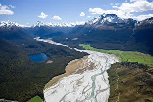
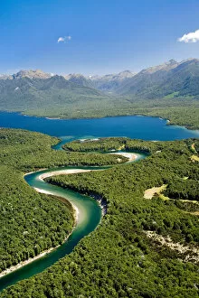
Dart River, near Glenorchy, South Island, New Zealand - aerial
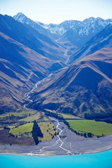
Dingle Burn entering Lake Hawea, South Island, New Zealand - aerial
Lake Wakatipu shallows near Outlet to Kawarau River, Queenstown, South Island, New Zealand - aerial
Lake Wakatipu, Kawarau River, and The Remarkables, Queenstown, South Island, New Zealand - aerial
Dart River, near Glenorchy, Queenstown Region, South Island, New Zealand - aerial
Lake Pukaki and Whale Stream, Ben Ohau Range, Mackenzie Country, South Island, New Zealand - aerial
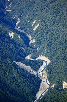
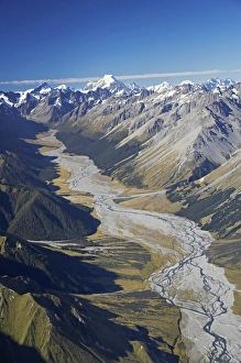
Dobson River and Aoraki / Mt Cook, South Island, New Zealand - aerial
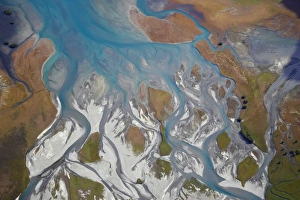
Hopkins River and Ram Hill, near Lake Ohau, South Island, New Zealand - aerial
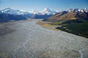
Aoraki / Mt Cook and Tasman River, South Canterbury, South Island, New Zealand - aerial
Lake Ohau and Ben Oahu, Mackenzie Country, South Canterbury, South Island, New Zealand - aerial
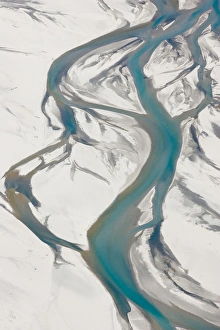
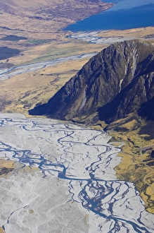
Tasman River and Ben Ohau Range, near Mt Cook, South Canterbury, South Island, New Zealand - aerial
Lake Ohau and Neumann Range (centre and right), Mackenzie Country, South Canterbury, South Island, New Zealand - aerial
Ohau River and Ohau Canal, Mackenzie Country, South Island, New Zealand - aerial
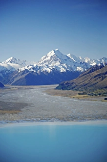
Aoraki / Mt Cook, Lake Pukaki and Tasman River, South Canterbury, South Island, New Zealand - aerial
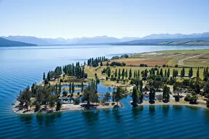
Marina, Lake Te Anau, Fiordland, South Island, New Zealand - aerial
Aoraki / Mt Cook and Lake Pukaki, South Canterbury, South Island, New Zealand - aerial
Waiau River and Lake Manapouri, Fiordland National Park, South Island, New Zealand - aerial
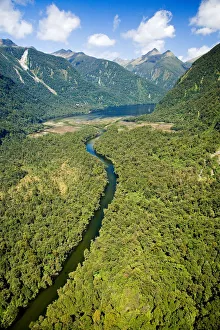
Camelot River and Shoal Bay, Gaer Arm, Bradshaw Sound, Fiordland National Park, South Island, New Zealand - aerial
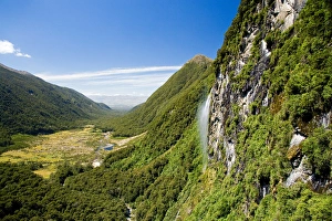
Waterfall near Iris Burn Hut, Iris Burn, Kepler Track, Fiordland National Park, South Island, New Zealand - aerial
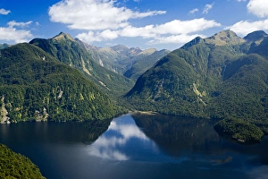
Bradshaw Sound, Fiordland National Park, South Island, New Zealand - aerial
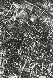
WORLD WAR II (1939-1945). Bombardment of Germany (November 1944)
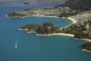
Kaiteriteri (top), Breaker Bay (middle right), Honeymoon Bay (far right), Nelson Region, South Island, New Zealand - aerial
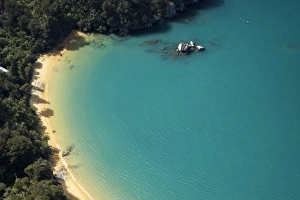
Split Apple Rock, Towers Bay, Kaiteriteri, Nelson Region, South Island, New Zealand - aerial
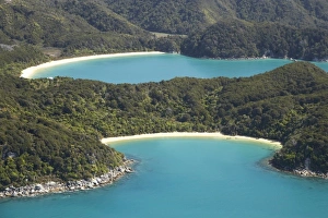
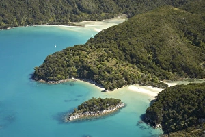
Te Pukatea Bay (front), and The Anchorage, Torrent Bay (back), Abel Tasman National Park, Nelson Region, South Island, New Zealand - aerial
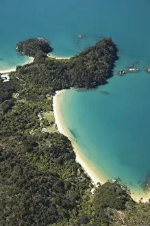
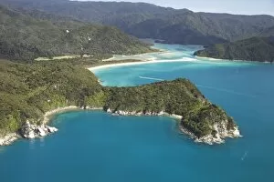
Boundary Bay (bottom) with Holiday Homes, North Head, and Frenchman Bay (top), Abel Tasman National Park, Nelson Region, South Island, New Zealand - aerial
Canoe Bay (front), Awaroa Head, and Awaroa Bay (back), and Awaroa Inlet, Abel Tasman National Park, Nelson Region, South Island, New Zealand - aerial
Mosquito Bay (bottom right) and Bark Bay (top left), Abel Tasman National Park, Nelson Region, South Island, New Zealand - aerial
Awaroa Bay, Awaroa Inlet, and Holiday Homes, Abel Tasman National Park, Nelson Region, South Island, New Zealand - aerial
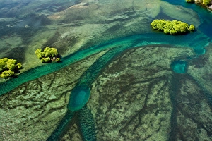
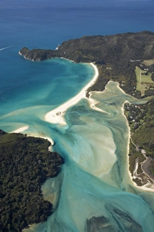
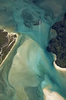
Tidal Patterns, Awaroa Inlet, Abel Tasman National Park, Nelson Region, South Island, New Zealand - aerial
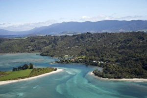
Parapara Inlet and Milnthorpe, Golden Bay, Nelson Region, South Island, New Zealand - aerial
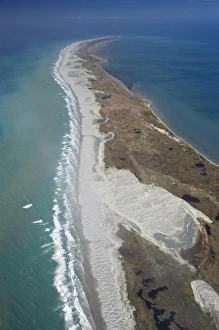
Farewell Spit and Tasman Sea (left), Golden Bay (right), Nelson Region, South Island, New Zealand - aerial
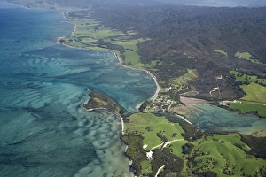
Port Puponga and Golden Bay, Nelson Region, South Island, New Zealand - aerial
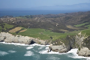
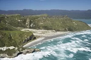
Rugged Coast at Cape Farewell, NW Nelson Region, South Island, New Zealand - aerial
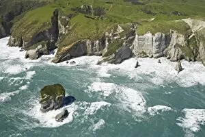
Rugged Coastline near Pilch Point and Wharariki Beach, south of Cape Farewell, NW Nelson Region, South Island, New Zealand - aerial
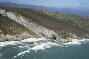
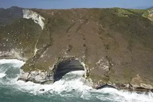
Coast south of Cape Farewell, NW Nelson Region, South Island, New Zealand - aerial
Rock Formations south of Cape Farewell, at Curious Cliff and Mount Lunar by Nguroa Bay NW Nelson Region, South Island, New Zealand - aerial
Coast south of Cape Farewell and Whanganui Inlet (right), NW Nelson Region, South Island, New Zealand - aerial