mail_outline sales@mediastorehouse.com
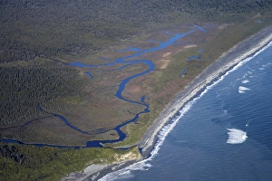
Five Mile Lagoon, near Franz Josef Glacier, West Coast, South Island, New Zealand - aerial
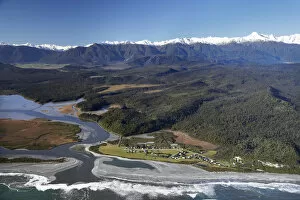
Okarito and Okarito Lagoon, West Coast, South Island, New Zealand - aerial
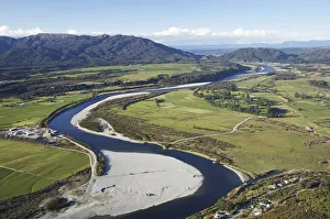
Grey River near Greymouth, West Coast, South Island, New Zealand - aerial
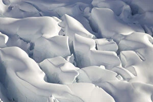
Crevasses, Tasman Glacier, Aoraki / Mt Cook National Park, South Island, New Zealand - aerial
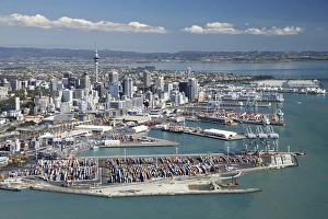
Ports of Auckland and Central Business District, , North Island, New Zealand - Aerial
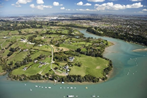
Mangemangeroa Creek, Auckland, North Island, New Zealand - Aerial
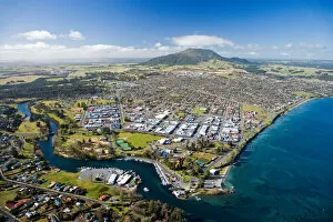
Taupo, Lake Taupo and Waikato River, North Island, New Zealand - aerial
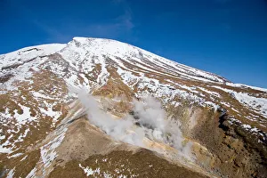
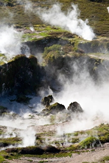
Ketetahi Hot Springs, Tongariro Crossing Track, Mt Tongariro, Tongariro National Park, Central Plateau, North Island, New Zealand - aerial
Waikato River and Lake Taupo, Taupo, North Island, New Zealand - aerial
Craters of the Moon Thermal Area, near Taupo, North Island, New Zealand - aerial
Crater on top of Mt Ngauruhoe, Tongariro National Park, Central Plateau, North Island, New Zealand - aerial
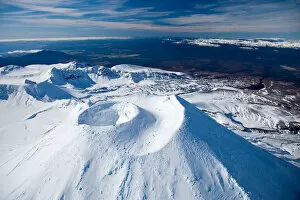
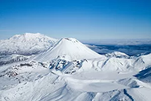
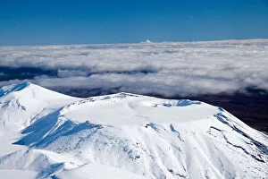
Crater on top of Mt Ngauruhoe, and Mt Ruapehu in distance, Tongariro National Park, Central Plateau, North Island, New Zealand - aerial
Lower Tama Lake and Mt Ruapehu, Tongariro National Park, Central Plateau, North Island, New Zealand - aerial
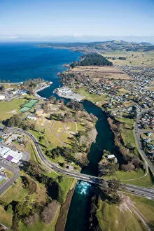
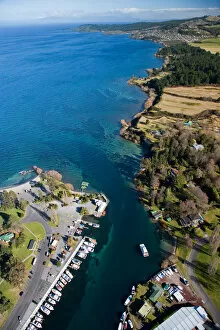
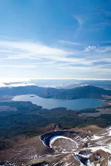
Marina at Source of Waikato River, by Lake Taupo, Taupo, North island, New Zealand - aerial
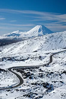
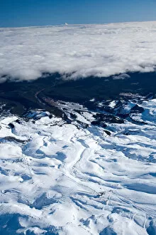
Bruce Road up Mt Ruapehu, and Mt Ngauruhoe, Tongariro National Park, Central Plateau, North Island, New Zealand - aerial
Blue Lake (frozen), Mt Tongariro (right), Mt Ngauruhoe (middle), and Mt Ruapehu (far left), Tongariro National Park, Central Plateau, North Island, New Zealand, aerial
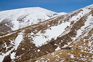
Ketetahi Hut, Tongariro Crossing Track, Mt Tongariro, Tongariro National Park, Central Plateau, North Island, New Zealand - aerial
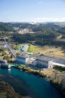
Wairakei Geothermal Power Station and Waikato River, near Taupo, North Island, New Zealand
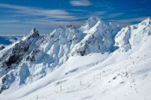
Whakapapa Skifield on Mt Ruapehu, Tongariro National Park, Central Plateau, North Island, New Zealand - aerial
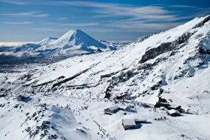
Whakapapa Skifield on Mt Ruapehu, and Mt Ngauruhoe (distance) Tongariro National Park, Central Plateau, North Island, New Zealand - aerial
Sulphur Lagoon Crater on Mt Tongariro, Tongariro National Park, Lake Rotoaira, and Lake Taupo (bottom to top), Central Plateau, North Island, New Zealand, aerial
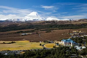
Mt Ngauruhoe and Grand Chateau, Tongariro National Park, Central Plateau, North Island, New Zealand - aerial
Turoa Skifield, Mt Ruapehu, Tongariro National Park, Central Plateau, North Island, New Zealand (and Mt Taranaki / Egmont in distance) - aerial
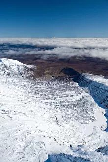
Lower Tama Lake and Mt Ruapehu (far left in distance), Tongariro National Park, Central Plateau, North Island, New Zealand - aerial
Tongariro Crossing Track (right, by shadow), Mt Ngauruhoe, Tongariro National Park, Central Plateau, North Island, New Zealand (and Mt Taranaki / Egmont in distance), aerial
Mt Tongariro, Tongariro National Park, Central Plateau, North Island, New Zealand (and Mt Taranaki / Egmont in distance) - aerial
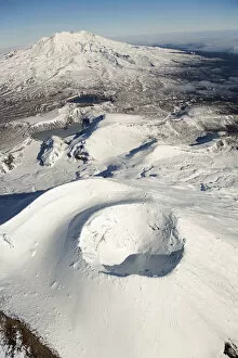
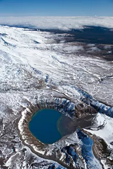
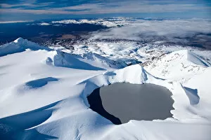
Crater Lake, Mt Ruapehu, Tongariro National Park, Central Plateau, North Island, New Zealand - aerial
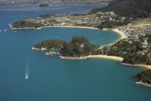
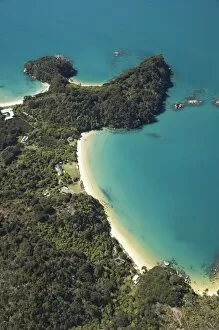
Kaiteriteri (top), Breaker Bay (middle right), Honeymoon Bay (far right), Nelson Region, South Island, New Zealand - aerial
Split Apple Rock, Towers Bay, Kaiteriteri, Nelson Region, South Island, New Zealand - aerial
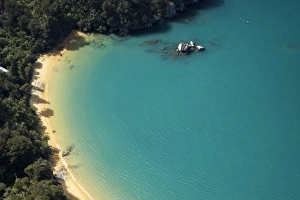
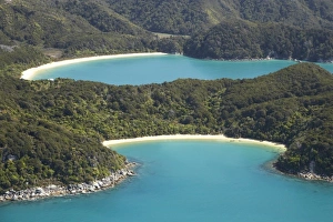
Te Pukatea Bay (front), and The Anchorage, Torrent Bay (back), Abel Tasman National Park, Nelson Region, South Island, New Zealand - aerial
Boundary Bay (bottom) with Holiday Homes, North Head, and Frenchman Bay (top), Abel Tasman National Park, Nelson Region, South Island, New Zealand - aerial
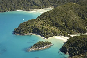
Canoe Bay (front), Awaroa Head, and Awaroa Bay (back), and Awaroa Inlet, Abel Tasman National Park, Nelson Region, South Island, New Zealand - aerial
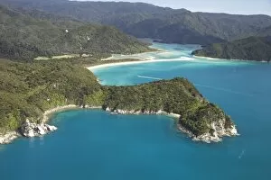
Mosquito Bay (bottom right) and Bark Bay (top left), Abel Tasman National Park, Nelson Region, South Island, New Zealand - aerial
Awaroa Bay, Awaroa Inlet, and Holiday Homes, Abel Tasman National Park, Nelson Region, South Island, New Zealand - aerial
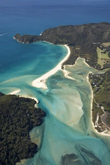
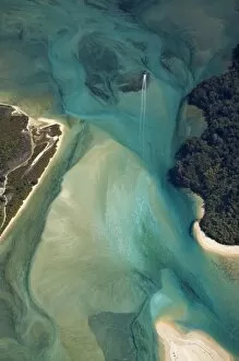
Tidal Patterns, Awaroa Inlet, Abel Tasman National Park, Nelson Region, South Island, New Zealand - aerial
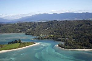
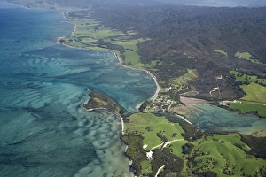
Parapara Inlet and Milnthorpe, Golden Bay, Nelson Region, South Island, New Zealand - aerial
Farewell Spit and Tasman Sea (left), Golden Bay (right), Nelson Region, South Island, New Zealand - aerial
Port Puponga and Golden Bay, Nelson Region, South Island, New Zealand - aerial
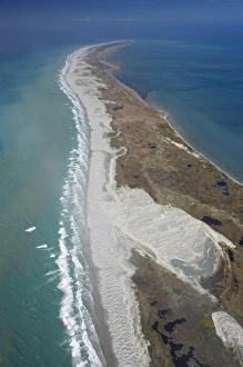
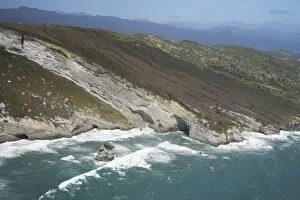
Rugged Coast at Cape Farewell, NW Nelson Region, South Island, New Zealand - aerial
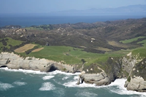
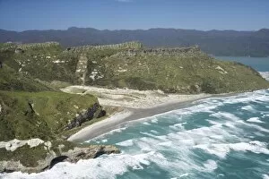
Rugged Coastline near Pilch Point and Wharariki Beach, south of Cape Farewell, NW Nelson Region, South Island, New Zealand - aerial
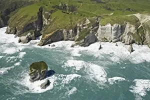
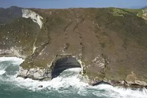
Coast south of Cape Farewell, NW Nelson Region, South Island, New Zealand - aerial
Rock Formations south of Cape Farewell, at Curious Cliff and Mount Lunar by Nguroa Bay NW Nelson Region, South Island, New Zealand - aerial
Coast south of Cape Farewell and Whanganui Inlet (right), NW Nelson Region, South Island, New Zealand - aerial
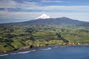
Taranaki Coastline near New Plymouth, Farmland and Mt Taranaki / Mt Egmont, Taranaki, North Island, New Zealand - aerial
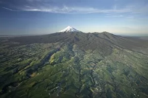
Frosty Farmland and Early Light on Mt Taranaki / Mt Egmont, Egmont National Park, Taranaki, North Island, New Zealand - aerial
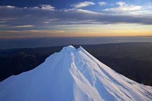
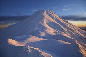
First Light on Summit of Mt Taranaki / Mt Egmont, Taranaki, North Island, New Zealand - aerial
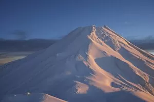
Syme Hut (at left), Fanthams Peak, and Alpenglow at Dawn on Mt Taranaki / Mt Egmont, Taranaki, North Island, New Zealand - aerial
Climbers at Syme Hut, Fanthams Peak, and Alpenglow at Dawn on Mt Taranaki / Mt Egmont, Taranaki, North Island, New Zealand - aerial