mail_outline sales@mediastorehouse.com
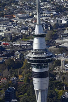
Sky Tower, Auckland, North Island, New Zealand - aerial
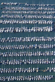
Westhaven Marina, Auckland, North Island, New Zealand - aerial
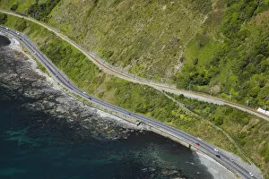
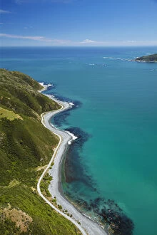
State Highway One and North Island Main Trunk Railway, between Paekakariki and Pukerua Bay, Wellington, North Island, New Zealand - aerial
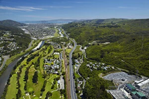
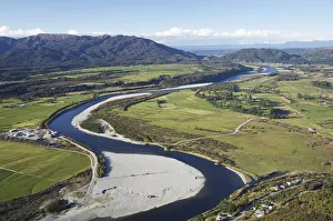
Hutt River, Manor Park Golf Course and State Highway Two, Lower Hutt, Wellington, North Island, New Zealand - aerial
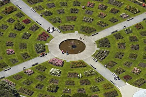
Lady Norwood Rose Garden, Wellington Botanic Garden, Wellington, North Island, New Zealand - aerial
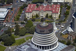
The Beehive, Parliament Grounds, and Old Government Buildings, Wellington, North Island, New Zealand - aerial
Shoreline near Eastbourne, and entrance to Wellington Harbour, Wellington, North Island, New Zealand - aerial
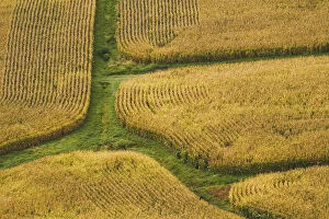
Farm crops, Rukuhia, near Hamilton, Waikato, North Island, New Zealand - aerial
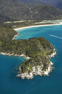
Canoe Bay, Awaroa Head, Awaroa Bay, Abel Tasman National Park, Nelson Region, South Island, New Zealand - aerial
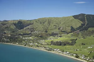
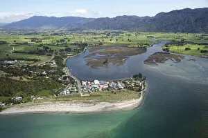
Pohara, near Takaka, Golden Bay, Nelson Region, South Island, New Zealand - aerial
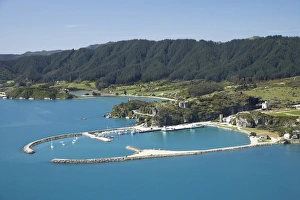
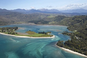
Tarakohe, Golden Bay, Nelson Region, South Island, New Zealand - aerial
Inlet, Onekaka, Golden Bay, Nelson Region, South Island, New Zealand - aerial
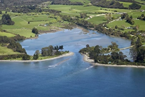
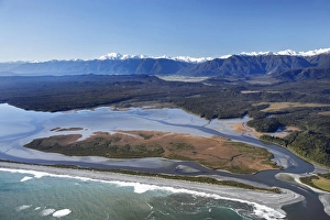
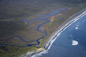
Collingwood and Aorere River Estuary, Golden Bay, Nelson Region, South Island, New Zealand - aerial
Parapara (left), Parapara Inlet and Milnthorpe (right), Golden Bay, Nelson Region, South Island, New Zealand - aerial
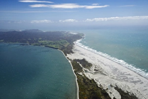
Farewell Spit and Tasman Sea, Nelson Region, South Island, New Zealand - aerial
Holiday Homes, Pakawau, and Burnett Range, Golden Bay, Nelson Region, South Island, New Zealand - aerial
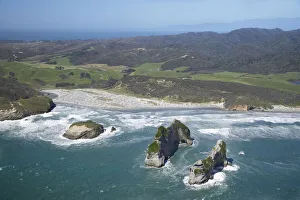
Rugged Coast at Pillar Point near Cape Farewell, NW Nelson Region, South Island, New Zealand - aerial
Farewell Spit and Golden Bay (left), Tasman Sea (right), Nelson Region, South Island, New Zealand - aerial
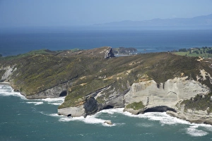
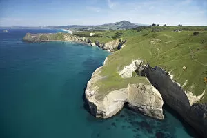
Archway Islands, Wharariki Beach, south of Cape Farewell, NW Nelson Region, South Island, New Zealand - aerial
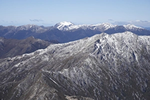
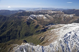
Lead Hills and Clark Peak, Kahurangi National Park, Nelson Region, South Island, New Zealand - aerial
Boulder Lake and Clark Peak (right front), Kahurangi National Park, Nelson Region, South Island, New Zealand - aerial
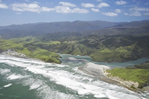
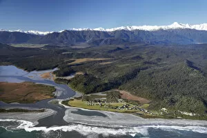
Anaweka River Mouth, NW Nelson Region, South Island, New Zealand - aerial
Early Light on Farmland near Mt Taranaki / Mt Egmont, Taranaki, North Island, New Zealand - aerial
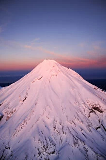
Alpenglow on Summit of Mt Taranaki / Mt Egmont at Dawn, Taranaki, North Island, New Zealand - aerial
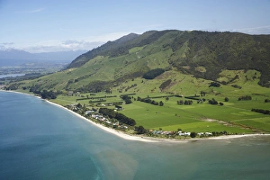
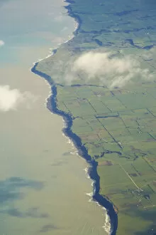
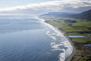
South Taranaki Coastline, North Island, New Zealand - aerial
Sea Cliffs near Blackhead, Dunedin, South Island, New Zealand - aerial
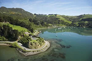
Rocky Point and Deborah Bay, Otago Harbour, Dunedin, South Island, New Zealand - aerial
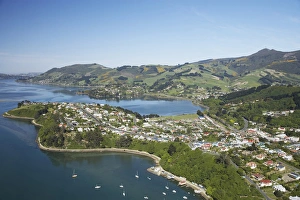
Port Chalmers, Otago Harbour, Dunedin, South Island, New Zealand - aerial
Pancake Rocks, Punakaiki, Paparoa National Park, West Coast, South Island, New Zealand - aerial
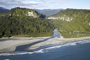
Pororari River Gorge, Punakaiki, Paparoa National Park, West Coast, South Island, New Zealand - aerial
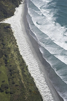
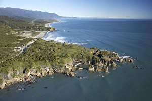
Pakiroa Beach, near Punakaiki, West Coast, South Island, New Zealand - aerial
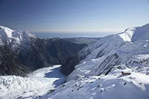
Almer Hut, above Franz Josef Glacier, West Coast, South Island, New Zealand - aerial
Group of Guided Glacier Walkers and Crevasses, Franz Josef Glacier, West Coast, South Island, New Zealand - aerial
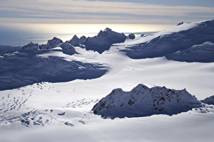
Chamberlin Snowfield and Mackay Rocks, above Franz Josef Glacier, West Coast, South Island, New Zealand - aerial
Okarito Lagoon, West Coast, South Island, New Zealand - aerial
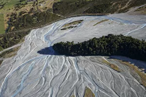
Waiho River near Franz Josef Glacier, West Coast, South Island, New Zealand - aerial
Five Mile Lagoon, near Franz Josef Glacier, West Coast, South Island, New Zealand - aerial
Okarito and Okarito Lagoon, West Coast, South Island, New Zealand - aerial
Grey River near Greymouth, West Coast, South Island, New Zealand - aerial
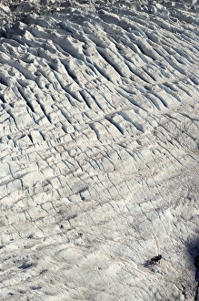
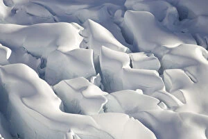
Crevasses, Tasman Glacier, Aoraki / Mt Cook National Park, South Island, New Zealand - aerial
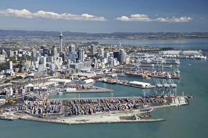
Ports of Auckland and Central Business District, , North Island, New Zealand - Aerial
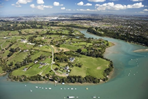
Mangemangeroa Creek, Auckland, North Island, New Zealand - Aerial
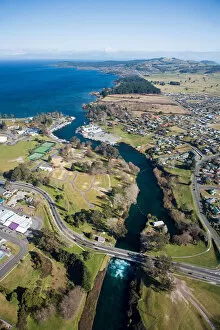
Taupo, Lake Taupo and Waikato River, North Island, New Zealand - aerial
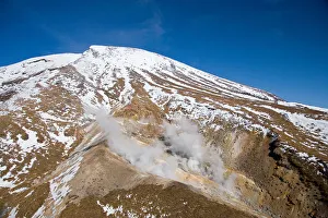
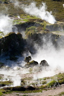
Ketetahi Hot Springs, Tongariro Crossing Track, Mt Tongariro, Tongariro National Park, Central Plateau, North Island, New Zealand - aerial
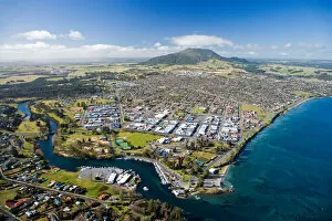
Waikato River and Lake Taupo, Taupo, North Island, New Zealand - aerial
Craters of the Moon Thermal Area, near Taupo, North Island, New Zealand - aerial
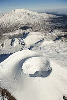
Crater on top of Mt Ngauruhoe, Tongariro National Park, Central Plateau, North Island, New Zealand - aerial
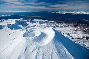
Crater on top of Mt Ngauruhoe, and Mt Ruapehu in distance, Tongariro National Park, Central Plateau, North Island, New Zealand - aerial