mail_outline sales@mediastorehouse.com
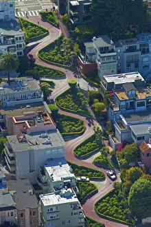
USA, California, San Francisco - Lombard Street (claimed to be the worlds crookedest street)USA, California, San Francisco - Lombard Street (claimed to be the worldas crookedest street), Russian Hill neighborhood - aerial
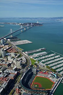
USA, California, San Francisco - AT&T Park / Giants Ballpark (home of San Francisco Giants baseball team), South Beach Marina, downtown San Francisco, and Bay Bridge - aerial
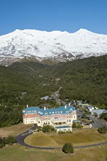
Mt Ruapehu and Grand Chateau, Tongariro National Park, Central Plateau, North Island, New Zealand - aerial
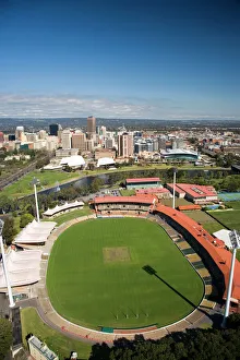
Adelaide Oval, River Torrens and Central Business District, Adelaide, South Australia, Australia - aerial
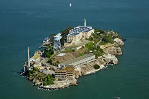
USA, California, San Francisco - Alcatraz Island, former maximum high-security federal prison, San Francisco Bay - aerial
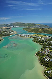
Pauatahanui Inlet, Porirua Harbour, Wellington Region, North Island, New Zealand - aerial
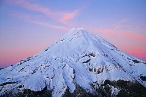
Summit of Mt Taranaki / Mt Egmont at Dawn, Taranaki, North Island, New Zealand - aerial
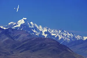
Gliders and Aoraki / Mt Cook, Mackenzie Country, South Island, New Zealand
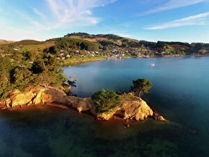
Yellow Point, Broad Bay and Otago Peninsula, Dunedin, South Island, New Zealand - drone aerial
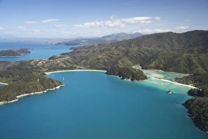
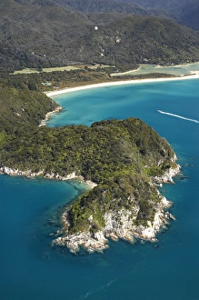
The Anchorage (left) and Torrent Bay (right), Abel Tasman National Park, Nelson Region, South Island, New Zealand - aerial
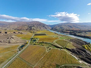
Vineyards, Felton Road, Bannockburn, and Kawarau Arm, Lake Dunstan, near Cromwell, Central Otago, South Island, New Zealand - drone aerial
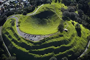
Volcanic crater, Mt Eden, ( historic Maori pa site ), Auckland, North Island, New Zealand - aerial
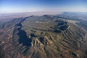
Wilpena Pound, Flinders Ranges, South Australia, Australia - aerial
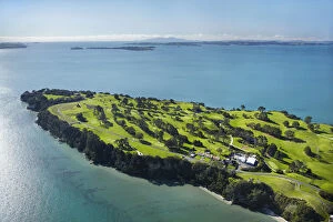
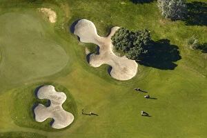
Howick Golf Course, Auckland, North Island, New Zealand - aerial
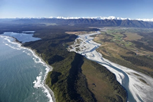
Whataroa River and Southern Alps, West Coast, South Island, New Zealand - aerial
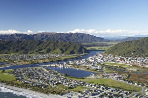
Greymouth, West Coast, South Island, New Zealand - aerial
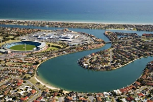
West Lakes, aMI Stadium, and West Lakes Mall, Adelaide, South Australia, Australia - aerial
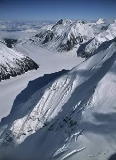
USA, Alaska, Peters Glacier, Aerial Photo, Denali National Park
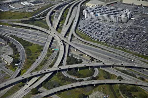
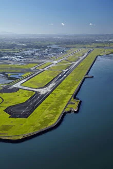
USA, California, San Francisco - Interchange of 1-380 and Bayshore Freeway (US 101) near San Francisco International Airport - aerial
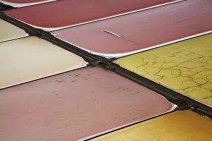
USA, California, San Francisco - Colourful algae in salt evaporation ponds, Redwood City, San Francisco Bay - aerial
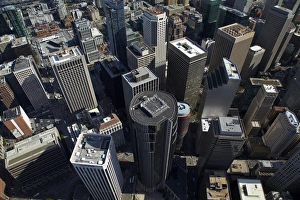
USA, California, San Francisco - Looking down onto skyscrapers, Market Street, in the financial district, downtown San Francisco - aerial
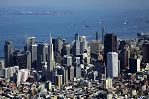
USA, California, San Francisco - Downtown San Francisco, and ships in San Francisco Bay - aerial
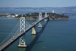
USA, California, San Francisco - San Franciscoaa'Oakland Bay Bridge (Bay Bridge)USA, California, San Francisco - San Franciscoa'Oakland Bay Bridge (Bay Bridge), crossing San Francisco Bay to Yerba Buena Island - aerial
USA, California, San Francisco - Municipal Pier and San Francisco Maritime National Historical Park - aerial
Runway at Auckland Airport, and Manukau Harbour, North Island, New Zealand - aerial
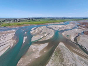
Waitaki River near coast, North Otago / South Canterbury border, South Island, New Zealand - drone aerial
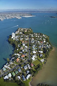
Stanley Point, Waitemata Harbour, and Auckland Harbour Bridge, Auckland, North Island, New Zealand - aerial
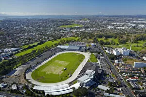
Alexandra Park Raceway, and Greenlane Clinical Centre, Auckland, North Island, New Zealand - aerial
Remuera Golf Course, Auckland, North Island, New Zealand - aerial
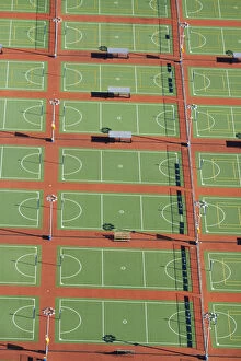
Netball Courts, Auckland Netball Centre, Mount Wellington, Auckland, North Island, New Zealand - aerial
Rental cars, Auckland Airport, North Island, New Zealand - aerial
Mapoutahi, Historic Maori Pa Site, Goat Island, Purakanui Bay, north of Dunedin, South Island, New Zealand - drone aerial
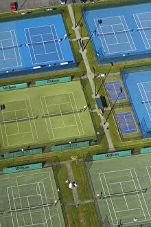
Tennis courts, Albany, Auckland, North Island, New Zealand - aerial
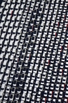
Car park, Auckland Airport, North Island, New Zealand - aerial
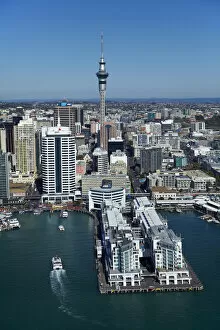
Hilton Hotel, Sky Tower, and Auckland waterfront, Auckland, North Island, New Zealand - aerial
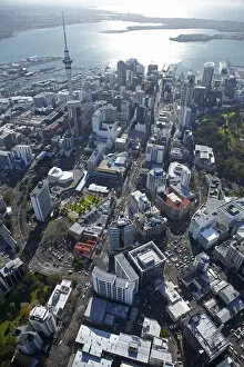
Queen Street, Sky Tower and Central Business District, Auckland, North Island, New Zealand - aerial
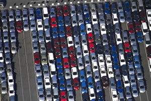
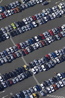
Newly imported vehicles at Ports of Auckland, Auckland, North Island, New Zealand - aerial
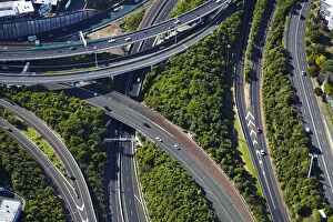
Spaghetti Junction (officially Central Motorway Junction), Newton, Auckland, North Island, New Zealand - aerial
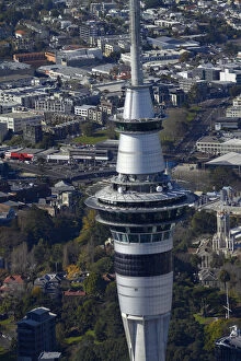
Sky Tower, Auckland, North Island, New Zealand - aerial
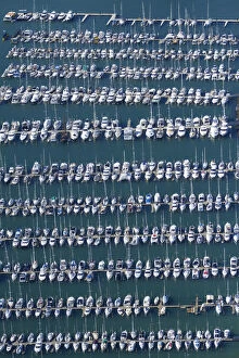
Westhaven Marina, Auckland, North Island, New Zealand - aerial
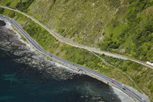
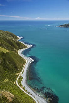
State Highway One and North Island Main Trunk Railway, between Paekakariki and Pukerua Bay, Wellington, North Island, New Zealand - aerial
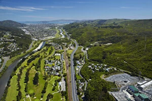
Hutt River, Manor Park Golf Course and State Highway Two, Lower Hutt, Wellington, North Island, New Zealand - aerial
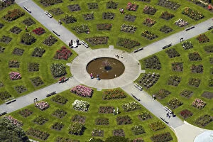
Lady Norwood Rose Garden, Wellington Botanic Garden, Wellington, North Island, New Zealand - aerial
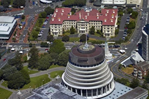
The Beehive, Parliament Grounds, and Old Government Buildings, Wellington, North Island, New Zealand - aerial
Shoreline near Eastbourne, and entrance to Wellington Harbour, Wellington, North Island, New Zealand - aerial
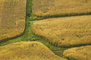
Farm crops, Rukuhia, near Hamilton, Waikato, North Island, New Zealand - aerial
Canoe Bay, Awaroa Head, Awaroa Bay, Abel Tasman National Park, Nelson Region, South Island, New Zealand - aerial
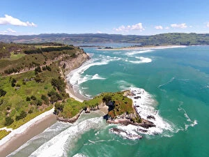
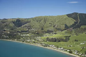
Pohara, near Takaka, Golden Bay, Nelson Region, South Island, New Zealand - aerial