mail_outline sales@mediastorehouse.com
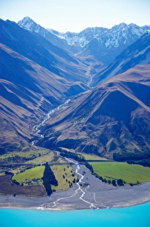
Lake Pukaki and Whale Stream, Ben Ohau Range, Mackenzie Country, South Island, New Zealand - aerial
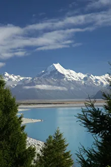
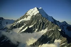
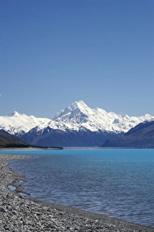
Aoraki / Mt Cook, and Lake Pukaki, Canterbury, South Island, New Zealand
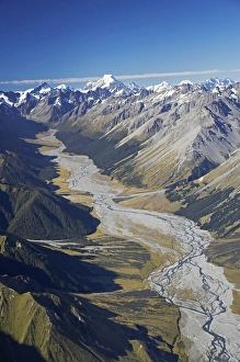
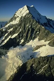
Dobson River and Aoraki / Mt Cook, South Island, New Zealand - aerial
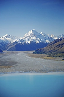
Aoraki / Mt Cook and Tasman River, South Canterbury, South Island, New Zealand - aerial
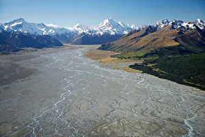
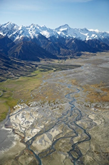
Tasman River and Ben Ohau Range, near Mt Cook, South Canterbury, South Island, New Zealand - aerial
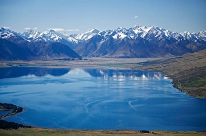
Lake Ohau and Neumann Range (centre and right), Mackenzie Country, South Canterbury, South Island, New Zealand - aerial
Aoraki / Mt Cook, Lake Pukaki and Tasman River, South Canterbury, South Island, New Zealand - aerial
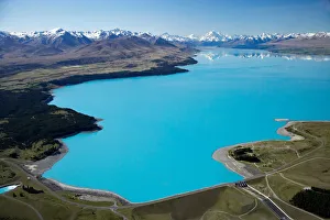
Aoraki / Mt Cook and Lake Pukaki, South Canterbury, South Island, New Zealand - aerial
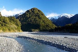
Waiho River, near Franz Josef Glacier, West Coast, South Island, New ZealandBridge and Waiho River, near Franz Josef Glacier, West Coast, South Island, New Zealand
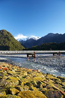
Bridge and Waiho River, near Franz Josef Glacier, West Coast, South Island, New Zealand
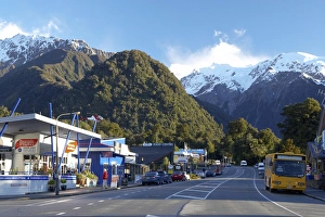
Franz Josef Glacer Township, West Coast, South Island, New Zealand
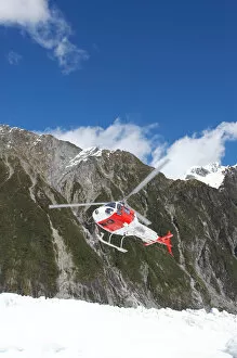
Helicopter, Franz Josef Glacier, West Coast, South Island, New Zealand
Helicopter (in distance), Franz Josef Glacier, West Coast, South Island, New Zealand
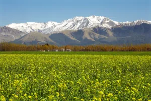
Rapeseed Field and Mountains near Methven, Canterbury, South Island, New Zealand
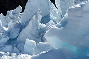
Ice Formations, Franz Josef Glacier, West Coast, South Island, New Zealand
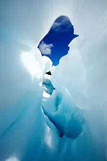
Blue Ice Cave, Franz Josef Glacier, West Coast, South Island, New Zealand
Canterbury Plains and Southern Alps, near Methven, South Island, New Zealand - aerial
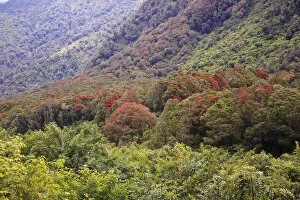
Oceania, New Zealand, South Island, Westland National Park, Fox Glacier. Colorful array of foliages including the Southern Rata Tree in Westland National Park
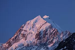
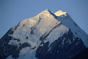
Alpenglow on Aoraki Mount Cook, Mackenzie Country, South Canterbury, South Island, New Zealand
Late light on Aoraki Mount Cook, Mackenzie Country, South Canterbury, South Island, New Zealand
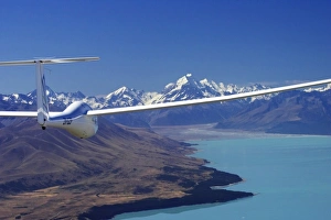
Glider, Lake Pukaki and Aoraki / Mt Cook, Mackenzie Country, South Island, New Zealand
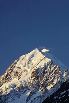
New Zealand, Mt. Cook, highest peak at 3754m. at sunset, Maori name is Aorangi (Cloud Piercer)
Mt. Cook, aerial, highest peak in New Zealand, 3754 m. Maori name Aorangi, (Cloud Piercer)
New Zealand, Mt. Cook, highest peak in New Zealand, 3754m. at sunset, Maori name is Aorangi (Cloud Piercer)
Aoraki Mount Cook and Lake Pukaki, Mackenzie Country, South Canterbury, South Island, New Zealand
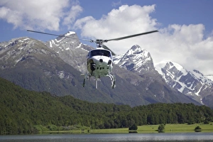
Helicopter, Diamond Lake, Paradise, near Glenorchy, Queenstown Region, South Island, New Zealand
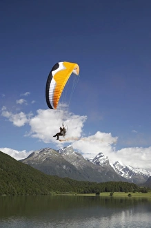
Paramotor, Diamond Lake, Paradise, near Glenorchy, Queenstown Region, South Island, New Zealand
Mt Elie de Beaumont, West Coast, South Island, New Zealand - aerial
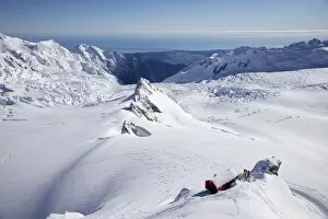
Centennial Hut, above Franz Josef Glacier, West Coast, South Island, New Zealand - aerial
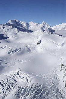
Salisbury Snowfield and Newton Rocks, above Franz Josef Glacier, West Coast, South Island, New Zealand - aerial
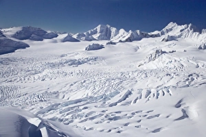
Franz Josef Glacier Neve, West Coast, South Island, New Zealand - aerial
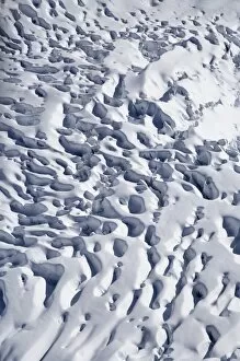
Crevasses, Franz Josef Glacier, West Coast, South Island, New Zealand - aerial
Kayakers, Lake Mapourika, and Southern Alps, West Coast, South Island, New Zealand - aerial
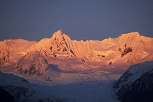
Alpenglow on Fox Glacier Neve, West Coast, South Island, New Zealand
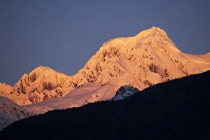
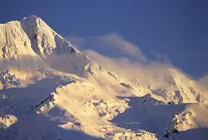
Alpenglow on Mt Tasman, seen from West Coast, South Island, New Zealand
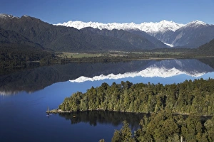
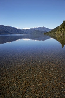
Lake Kaniere, West Coast, South Island, New Zealand
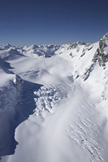
Tasman Glacier, Aoraki / Mt Cook National Park, South Island, New Zealand - aerial
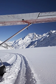
Ski Plane on Tasman Glacier and Aoraki / Mt Cook, Aoraki / Mt Cook National Park, South Island, New Zealand
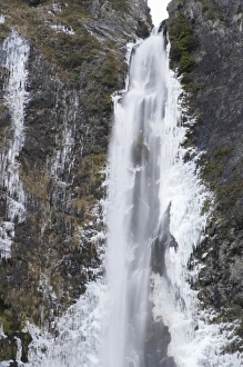
Devils Punchbowl Falls, Frozen in Winter, Arthurs Pass, Canterbury, South Island, New Zealand
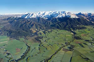
Farmland near Methven and Winterslow Range, Mid Canterbury, South Island, New Zealand
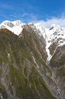
The Footstool, Mount Sefton, Mount Cook National Park, Southern Alps, South Island, New Zealand
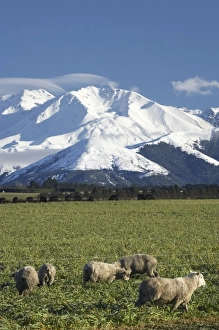
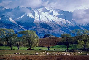
Sheep grazing below the snow-capped Harris Mountains in the Southern Alps near the town of Wanaka on the South Island of New Zealand in August