mail_outline sales@mediastorehouse.com
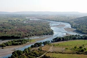
Albania, Shkodra. Drinit and Kir river flowing into the river Buna
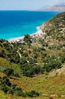
Albania, Piqueras. Bunets beach
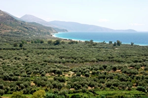
Albania, Olive grove next to Borsh beach
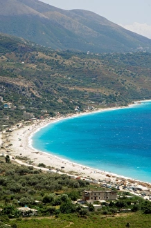
Albania, Borsh Beach
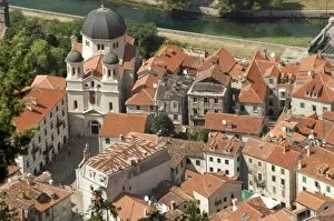
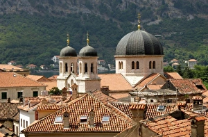
Montenegro, Kotor. View of the city with the church of St. Nicholas. In 1979 UNESCO declared World Heritage the whole Natural, Cultural and Historical region of Kotor
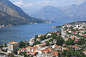
Montenegro, Kotor. View of the city along the fjord. In 1979 UNESCO declared World Heritage the whole Natural, Cultural and Historical region of Kotor
Montenegro, Kotor. Partial view of the city with the church of St. Nicholas. In 1979 UNESCO declared World Heritage the whole Natural, Cultural and Historical region of Kotor
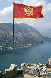
Flag of the Republic of Montenegro with the fjord at the background. Kotor
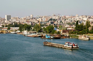
Serbia, Belgrade. Town and Sava River
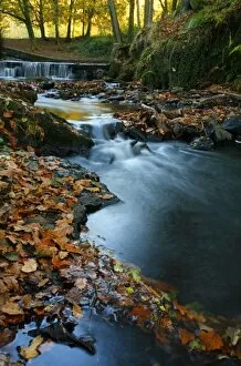
Stream with Fall Leaves in the Forest of Dean, UK
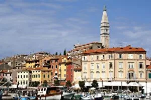
Croatia. Rovinj. View of the city with the St. Euphemia. Church. Istrian Peninsula
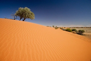
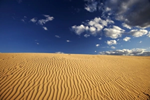
Sand Dunes, Strzelecki Track, Outback, South Australia, Australia
Strzelecki Track, Outback, South Australia, Australia
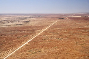
Oodnadatta Track, and Old Ghan Train Line, near William Creek, Outback, South Australia, Australia - aerial
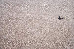
Shadow of Plane on Lake Eyre Salt Lake (15m below sea level), Lake Eyre National Park, Outback, South Australia, Australia - aerial
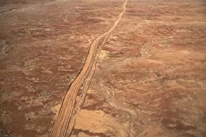
Desert Track near William Creek, Outback, South Australia, Australia - aerial
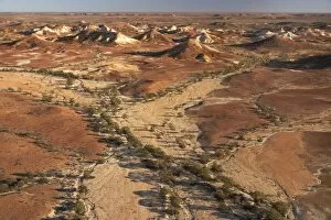
Painted Hills, near William Creek, Outback, South Australia, Australia - aerial
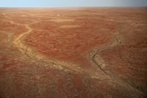
Dry River Bed near William Creek, Outback, South Australia, Australia - aerial
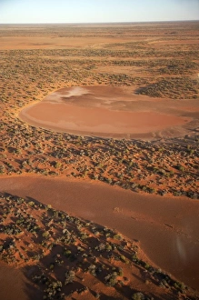
Dry Lakes near William Creek, Outback, South Australia, Australia - aerial
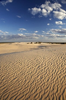
Lizard Tracks and Sand Dune, Mungo National Park, Outback New South Wales, Australia
Sand Dunes, Mungo National Park, Outback New South Wales, Australia
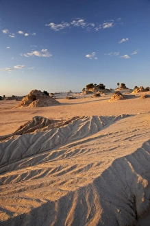
Walls of China Formations, Mungo National Park, Outback New South Wales, Australia
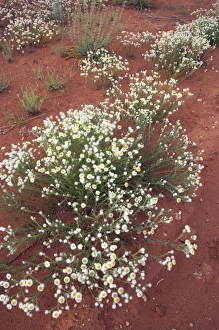
Wildflowers, Outback, New South Wales, Australia
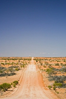
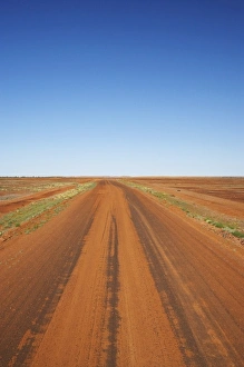
Outback Road, Sturt National Park, New South Wales, Australia
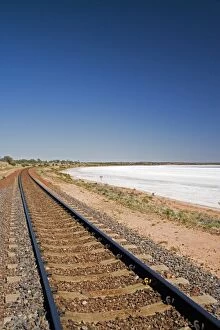
Railway Line by Lake Hart, Stuart Highway near Woomera, Outback, South Australia, Australia
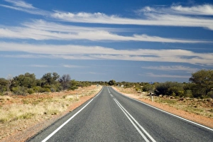
Stuart Highway, Outback, Northern Territory, Australia
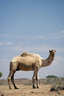
Camel near Stuart Highway, Outback, Northern Terrtory, Australia
Sopelana beach. Biscay, Basque Country
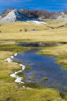
Gorbea Natural Park. Campas de Araba. Biscay, Basque Country
Cantabria. Landscape from Faro del Caballo on Mount Buciero. Santona. Spain
Ason river. Ramales de la Victoria. Cantabria. Spain
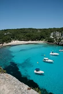
Sailboat. Balearic Islands. Menorca Island. Cala Macarella. Landscape coast. South island. Spain
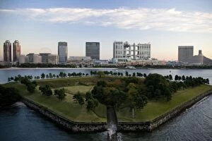
Japan. Tokyo. Odaiba Area with Fuji TV. building
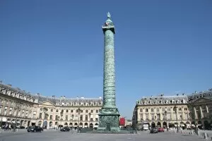
France. Paris. Vendome Square. Built by architect Hadouin-Mansart between 1687-1720. At the center, the Column Vendome erected by Napoleon Bonaparte to commemorate the Battle of Austerlitz
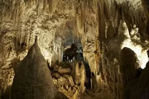
Aranui Cave, Waitomo, King Country, North Island, New Zealand
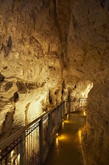
Ruakuri Caves, Waitomo, King Country, North Island, New Zealand
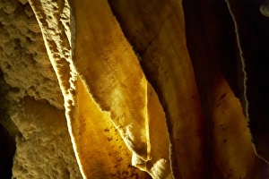
Stalactite, Ruakuri Caves, Waitomo, King Country, North Island, New Zealand
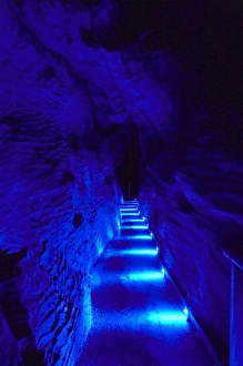
Blue Lights, Ruakuri Caves, Waitomo, King Country, North Island, New Zealand
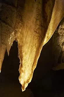
Stalactites, Ruakuri Caves, Waitomo, King Country, North Island, New Zealand
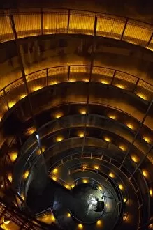
Spiral Ramp into Ruakuri Caves, Waitomo, King Country, North Island, New Zealand