mail_outline sales@mediastorehouse.com
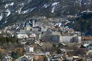
FRANCE-French Alps (Haut-Alpes)-BRIANCON: Town View / Daytime Europes Highest Town (elevFRANCE, French Alps (Haut, Alpes), BRIANCON: Town View / Daytime Europes Highest Town (elev. 4334Ft/1321 M)
Gorbea Natural Park. Aldamin mount view from Gorbea mount. Biscay province. Basque CountryGorbea Natural Park. Aldamin mount view from Gorbea mount. Biscay province, Basque country, Spain
Upper Austria, Austria - Tree covered mountainside. Vertical shotUpper Austria, Austria - Tree covered mountainside
Upper Austria, Austria - High angle view of mountains and a valley. Horizontal shotUpper Austria, Austria - High angle view of mountains and a valley
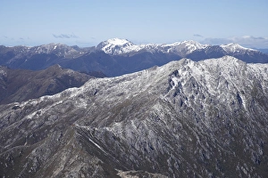
Lead Hills and Clark Peak, Kahurangi National Park, Nelson Region, South Island, New Zealand - aerial
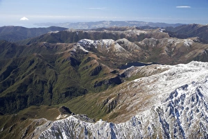
Boulder Lake and Clark Peak (right front), Kahurangi National Park, Nelson Region, South Island, New Zealand - aerial
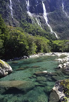
Cleddau River by Milford Road, near Milford Sound, Fiordland National ParkNew Zealand, Cleddau River by Milford Road, near Milford Sound, Fiordland National Park
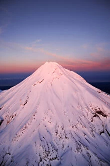
Alpenglow on Summit of Mt Taranaki / Mt Egmont at Dawn, Taranaki, North Island, New Zealand - aerial
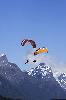
Paramotor and Mt Chaos, Paradise, near Glenorchy, Queenstown Region, South Island, New Zealand
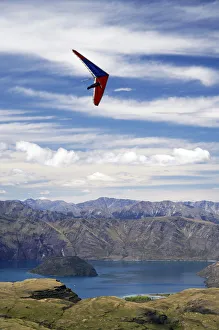
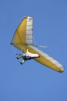
Hang Glider above Lake Wanaka, South Island, New Zealand
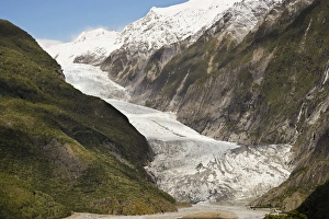
Franz Josef Glacier, Westland National Park, West Coast, South Island, New Zealand
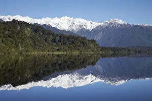
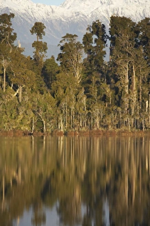
Reflections, Lake Mapourika, West Coast, South Island, New Zealand
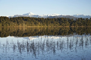
Native Forest Reflected in Lake Mahinapua, near Hokitika, West Coast, South Island, New Zealand
Mt Bowen and Lake Mahinapua, near Hokitika, West Coast, South Island, New Zealand
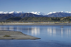
Hokitika River and Southern Alps, West Coast, South Island, New Zealand
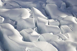
Crevasses, Tasman Glacier, Aoraki / Mt Cook National Park, South Island, New Zealand - aerial
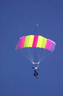
Parachuter, Omarama, North Otago, South Island, New Zealand
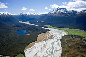
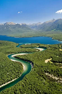
Dart River, near Glenorchy, South Island, New Zealand - aerial
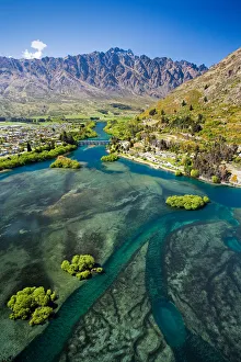
Lake Wakatipu, Kawarau River, and The Remarkables, Queenstown, South Island, New Zealand - aerial
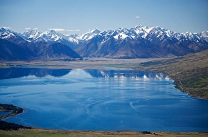
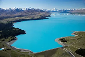
Lake Pukaki and Whale Stream, Ben Ohau Range, Mackenzie Country, South Island, New Zealand - aerial
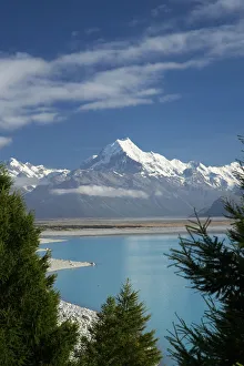
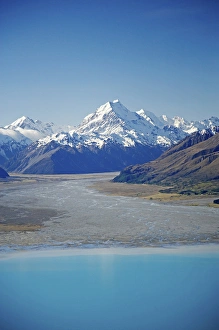
Aoraki / Mt Cook, and Lake Pukaki, Canterbury, South Island, New Zealand
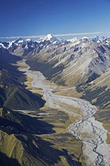
Dobson River and Aoraki / Mt Cook, South Island, New Zealand - aerial
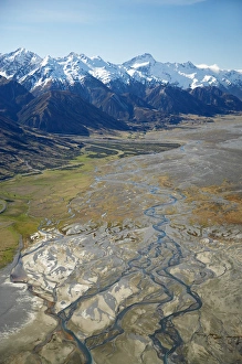
Aoraki / Mt Cook and Tasman River, South Canterbury, South Island, New Zealand - aerial
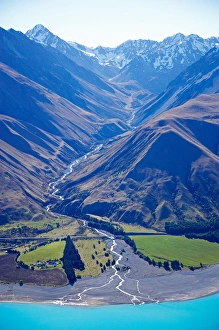
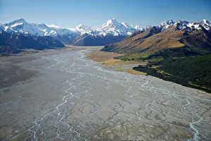
Tasman River and Ben Ohau Range, near Mt Cook, South Canterbury, South Island, New Zealand - aerial
Lake Ohau and Neumann Range (centre and right), Mackenzie Country, South Canterbury, South Island, New Zealand - aerial
Aoraki / Mt Cook, Lake Pukaki and Tasman River, South Canterbury, South Island, New Zealand - aerial
Aoraki / Mt Cook and Lake Pukaki, South Canterbury, South Island, New Zealand - aerial
Waiau River and Lake Manapouri, Fiordland National Park, South Island, New Zealand - aerial
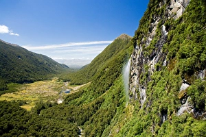
Waterfall near Iris Burn Hut, Iris Burn, Kepler Track, Fiordland National Park, South Island, New Zealand - aerial
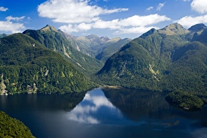
Bradshaw Sound, Fiordland National Park, South Island, New Zealand - aerial
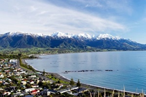
Kaikoura Township and Seaward Kaikoura Ranges, Marlborough, South Island, New Zealand
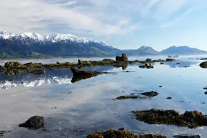
Seaward Kaikoura Ranges, Kaikoura, Marlborough, South Island, New Zealand
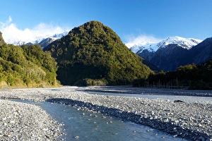
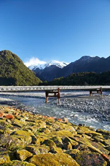
Waiho River, near Franz Josef Glacier, West Coast, South Island, New ZealandBridge and Waiho River, near Franz Josef Glacier, West Coast, South Island, New Zealand
Bridge and Waiho River, near Franz Josef Glacier, West Coast, South Island, New Zealand
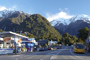
Franz Josef Glacer Township, West Coast, South Island, New Zealand
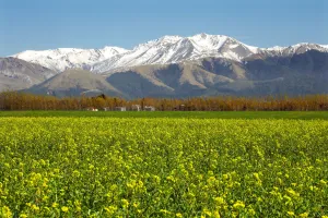
Rapeseed Field and Mountains near Methven, Canterbury, South Island, New Zealand
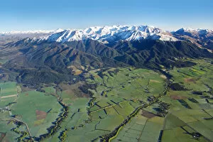
Canterbury Plains and Southern Alps, near Methven, South Island, New Zealand - aerial
Hang glider, Otago Peninsula, South Island, New Zealand
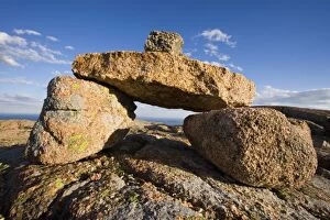
A rock cairn on Cadillac Mountain in Maines Acadia National Park. South Ridge Trail
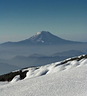
Mount Baker, Washington State, USA
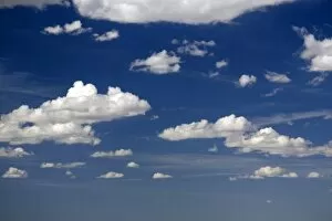
Blue sky and cumulus clouds over Wyoming, USA
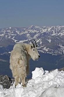
USA, Colorado, Mount Evans. Mountain goat and Rocky Mountains
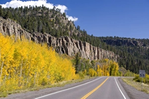
Colorado, Wolf Creek Pass
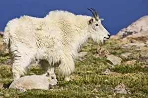
USA, Colorado, Rocky Mountains, Mount Evans, Mountain Goat (Oreamnos americanus) adult with baby in alpine meadow and rocky outcroppings, June
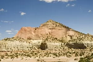
USA, NM, Red Rock State Park. Pyramid Rock highest elevation in Red Rock area. Excellent hiking, panoramic views
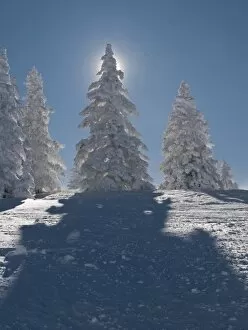
Snow covered trees at Santa Fe Ski Area
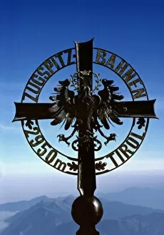
Germany, Bavaria, Zugspitze. This locator cross, at the Zugspitze, marks the border between Germany and Austria