mail_outline sales@mediastorehouse.com
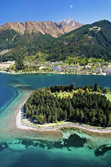
Queenstown and Lake Wakatipu, South Island, New Zealand - aerial
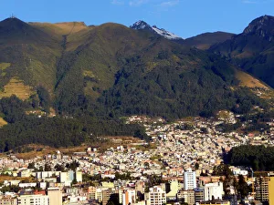
Americas, South America, Ecuador, Quito. At over 9, 000 feet in elevation, the capitol of EcuadorEcuador, Quito. At over 9, 000 feet in elevation Quito sits in a valley surrounded by the Andes mountains, providing countless scenic vistas. Quito was the first established UNESCO World Heritage site
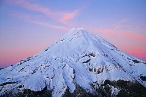
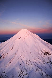
Summit of Mt Taranaki / Mt Egmont at Dawn, Taranaki, North Island, New Zealand - aerial
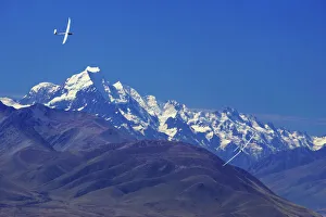
Gliders and Aoraki / Mt Cook, Mackenzie Country, South Island, New Zealand
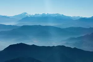
Andes Mountain Range with glaciers. Photographed from commercial airline, Southern Chile
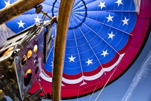
USA, Albuquerque, New Mexico, International Albuquerque Balloon Fiesta
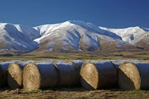
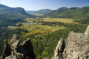
Hay bales and Kakanui Mountains, Kyeburn, near Ranfurly, Maniototo, Central Otago, South Island, New Zealand
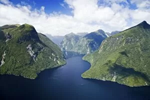
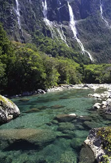
Crooked Arm, Malaspina Reach, Doubtful Sound, Fiordland National Park, South Island, New Zealand - aerial
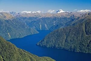
South Fiord, Lake Te Anau, Fiordland National Park, South Island, New Zealand - aerial
Mount Nebo Fall, Mount Nebo Scenic Byway, Uinta-Wasatch- Cache National Forest near NephiMount Nebo Fall, Mount Nebo Scenic Byway, Uinta-Wasatch-Cache National Forest near Nephi and Salt Lake City, Utah
Mount Nebo Scenic Byway, Uinta-Wasatch- Cache National Forest near Nephi and Salt Lake CityMount Nebo Scenic Byway, Uinta-Wasatch-Cache National Forest near Nephi and Salt Lake City, Utah
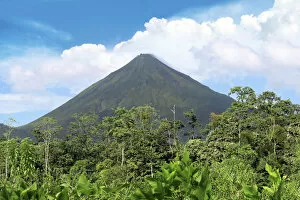
Arenal Volcano, Arenal Volcano National Park, Costa Rica
South America, Peru, Cusco. Peru Rails Andean Explorer first class train journey from Cusco to Puno
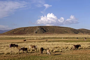
South America, Peru, the Andes. Cows grazing on an Andean plateau
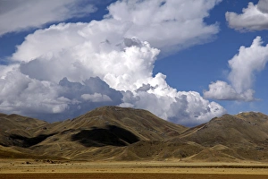
South America, Peru. The scenic skies of the high Andes, en route between Cusco and Puno
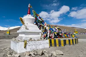
India, Jammu & Kashmir, Ladakh large chorton festooned with prayer flags at the top of the 17India, Jammu & Kashmir, Ladakh large chorten festooned with prayer flags at the top of the 17, 582 ft. Taglangla Pass on the Manali-Leh Road
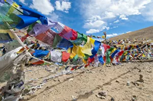
India, Jammu & Kashmir, Ladakh, Namshangla Pass strings of prayer flags
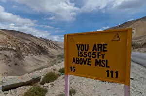
India, Jammu & Kashmir, Ladakh a road sign announcing You Are 15505 Ft Above MSL along the Manali-Leh highway
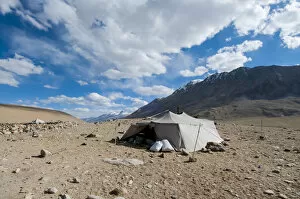
India, Jammu & Kashmir, Ladakh a nomads tent high in the mountains
Sheep and Kakanui Mountains, Kyeburn, near Ranfurly, Maniototo, Central Otago, South Island, New Zealand
Pyramid Rock Trail
Colorado, Roadside views between Pagosa (healing waters) Springs & Wolf Creek Pass. San Juan National Forest
Colorado, US Hwy 550 (aka Million Dollar Highway), Red Mountain Pass between Ouray & Silverton. San Juan Skyway, Colorados frist scenic byway
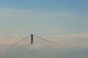
San Francisco, California. Golden Gate Bridge above fog bank
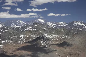
South America, Chile, Andes Mountains, near Santiago - aerial
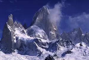
South America, Argentina, Los Glaciares National Park. Cerro Fitz RoyArgentina, Los Glaciares National Park. Cerro Fitz Roy
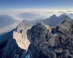
Germany, Bavaria, Zugspitze. Jagged mountain ridges fan out from the Zugspitze in the Bavarian Alps, Germany
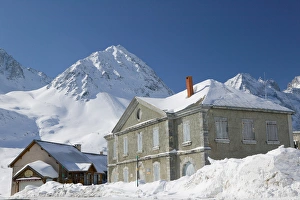
FRANCE-French Alps (Haut-Alpes)-Col DU LAUTARET: High Mountain Pass (elev. 2057m / 6749Ft)FRANCE, French Alps (Haut, Alpes), Col DU LAUTARET: High Mountain Pass (elev. 2057m/6749Ft), Buildings
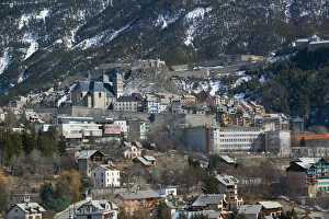
FRANCE-French Alps (Haut-Alpes)-BRIANCON: Town View / Daytime Europes Highest Town (elevFRANCE, French Alps (Haut, Alpes), BRIANCON: Town View / Daytime Europes Highest Town (elev. 4334Ft/1321 M)
Gorbea Natural Park. Aldamin mount view from Gorbea mount. Biscay province. Basque CountryGorbea Natural Park. Aldamin mount view from Gorbea mount. Biscay province, Basque country, Spain
Upper Austria, Austria - Tree covered mountainside. Vertical shotUpper Austria, Austria - Tree covered mountainside
Upper Austria, Austria - High angle view of mountains and a valley. Horizontal shotUpper Austria, Austria - High angle view of mountains and a valley
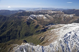
Lead Hills and Clark Peak, Kahurangi National Park, Nelson Region, South Island, New Zealand - aerial
Boulder Lake and Clark Peak (right front), Kahurangi National Park, Nelson Region, South Island, New Zealand - aerial
Cleddau River by Milford Road, near Milford Sound, Fiordland National ParkNew Zealand, Cleddau River by Milford Road, near Milford Sound, Fiordland National Park
Alpenglow on Summit of Mt Taranaki / Mt Egmont at Dawn, Taranaki, North Island, New Zealand - aerial
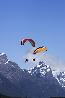
Paramotor and Mt Chaos, Paradise, near Glenorchy, Queenstown Region, South Island, New Zealand
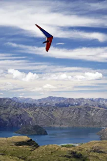
Hang Glider above Lake Wanaka, South Island, New Zealand
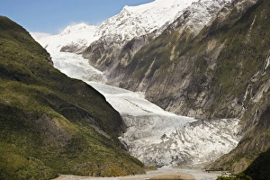
Franz Josef Glacier, Westland National Park, West Coast, South Island, New Zealand
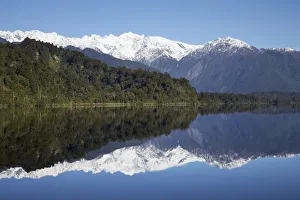
Reflections, Lake Mapourika, West Coast, South Island, New Zealand
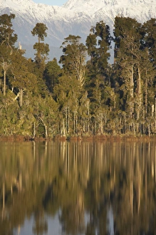
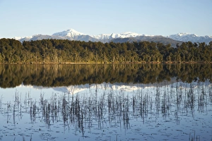
Native Forest Reflected in Lake Mahinapua, near Hokitika, West Coast, South Island, New Zealand
Mt Bowen and Lake Mahinapua, near Hokitika, West Coast, South Island, New Zealand
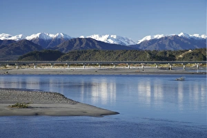
Hokitika River and Southern Alps, West Coast, South Island, New Zealand
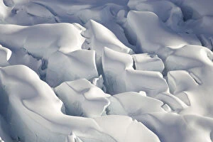
Crevasses, Tasman Glacier, Aoraki / Mt Cook National Park, South Island, New Zealand - aerial
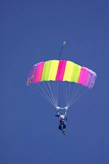
Parachuter, Omarama, North Otago, South Island, New Zealand
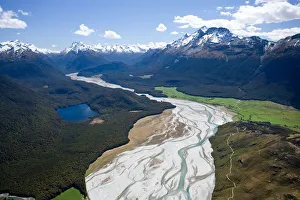
Dart River, near Glenorchy, South Island, New Zealand - aerial
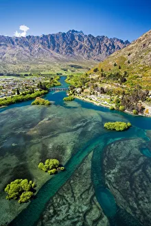
Lake Wakatipu, Kawarau River, and The Remarkables, Queenstown, South Island, New Zealand - aerial
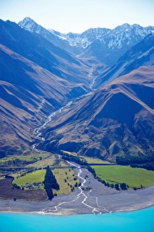
Lake Pukaki and Whale Stream, Ben Ohau Range, Mackenzie Country, South Island, New Zealand - aerial