mail_outline sales@mediastorehouse.com
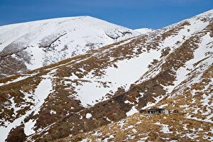
Ketetahi Hut, Tongariro Crossing Track, Mt Tongariro, Tongariro National Park, Central Plateau, North Island, New Zealand - aerial
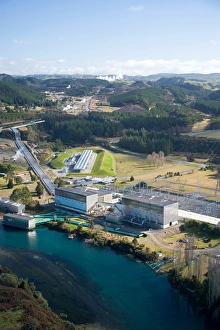
Wairakei Geothermal Power Station and Waikato River, near Taupo, North Island, New Zealand
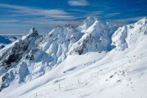
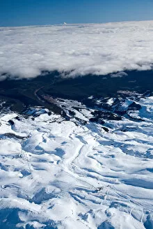
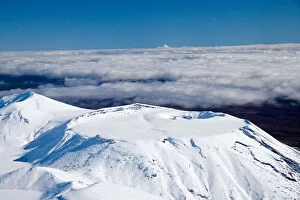
Whakapapa Skifield on Mt Ruapehu, Tongariro National Park, Central Plateau, North Island, New Zealand - aerial
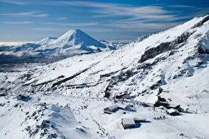
Whakapapa Skifield on Mt Ruapehu, and Mt Ngauruhoe (distance) Tongariro National Park, Central Plateau, North Island, New Zealand - aerial
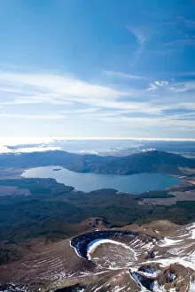
Sulphur Lagoon Crater on Mt Tongariro, Tongariro National Park, Lake Rotoaira, and Lake Taupo (bottom to top), Central Plateau, North Island, New Zealand, aerial
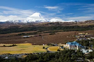
Mt Ngauruhoe and Grand Chateau, Tongariro National Park, Central Plateau, North Island, New Zealand - aerial
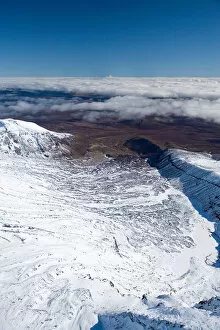
Turoa Skifield, Mt Ruapehu, Tongariro National Park, Central Plateau, North Island, New Zealand (and Mt Taranaki / Egmont in distance) - aerial
Lower Tama Lake and Mt Ruapehu (far left in distance), Tongariro National Park, Central Plateau, North Island, New Zealand - aerial
Tongariro Crossing Track (right, by shadow), Mt Ngauruhoe, Tongariro National Park, Central Plateau, North Island, New Zealand (and Mt Taranaki / Egmont in distance), aerial
Mt Tongariro, Tongariro National Park, Central Plateau, North Island, New Zealand (and Mt Taranaki / Egmont in distance) - aerial
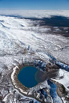
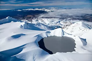
Crater Lake, Mt Ruapehu, Tongariro National Park, Central Plateau, North Island, New Zealand - aerial
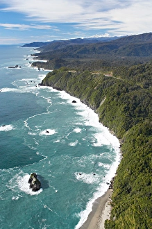
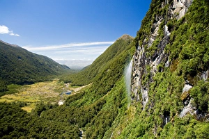
Knights Point, West Coast, South Island, New Zealand - aerial
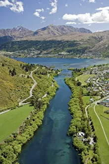
Kawarau River leaving Lake Wakatipu at Frankton, near Queenstown, South Island, New Zealand - aerial
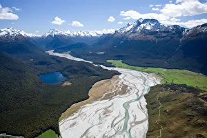
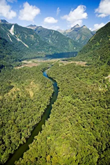
Dart River, near Glenorchy, South Island, New Zealand - aerial
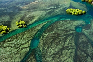
Lake Wakatipu shallows near Outlet to Kawarau River, Queenstown, South Island, New Zealand - aerial
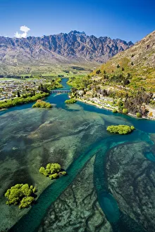
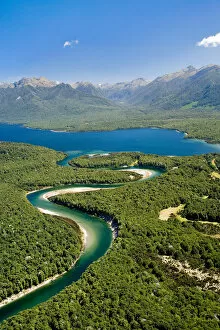
Lake Wakatipu, Kawarau River, and The Remarkables, Queenstown, South Island, New Zealand - aerial
Dart River, near Glenorchy, Queenstown Region, South Island, New Zealand - aerial
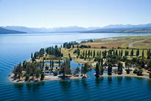
Marina, Lake Te Anau, Fiordland, South Island, New Zealand - aerial
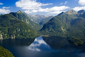
Waiau River and Lake Manapouri, Fiordland National Park, South Island, New Zealand - aerial
Camelot River and Shoal Bay, Gaer Arm, Bradshaw Sound, Fiordland National Park, South Island, New Zealand - aerial
Waterfall near Iris Burn Hut, Iris Burn, Kepler Track, Fiordland National Park, South Island, New Zealand - aerial
Bradshaw Sound, Fiordland National Park, South Island, New Zealand - aerial
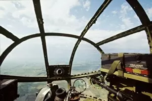
B-25 Miss Mitchell showing the nose of the plane from the Bombadier Navigator position
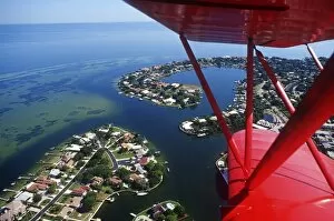
Aerial view of the Clearwater Peninsula, Florida, USA
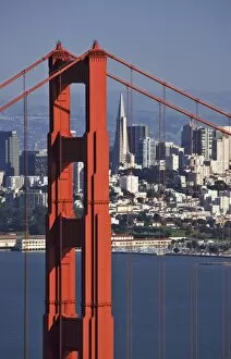
USA, California, San Francisco. Aerial view of the Golden Gate Bridge and the downtown area
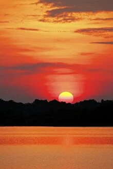
Amazon Jungle, Brazil, Sunsets over the Amazon river and jungle
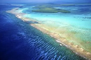
Aerial view of Barrier Reef, Belize, Central America
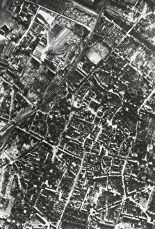
WORLD WAR II (1939-1945). Bombardment of Germany (November 1944)
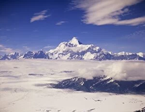
Aerial view of Mount Saint Elias, Malaspina Glacier and low clouds, Tongass National Forest, Alaska
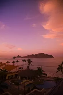
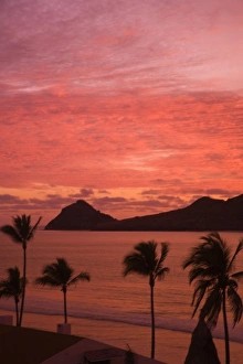
Early morning light, aerial view of Deer Island from Golden Zone Hotel, Mazatlan, Sinaloa State, Mexico
Aerial View of Deer Island from Golden Zone Hotel, Mazatlan, Sinaloa State, Mexico
Aerial View from top of sailboat, Chileno Bay and Beach near Cabo San Lucas, Baja California, Mexico
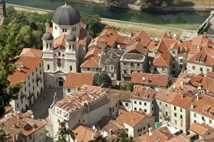
Montenegro, Kotor. View of the city with the church of St. Nicholas. In 1979 UNESCO declared World Heritage the whole Natural, Cultural and Historical region of Kotor
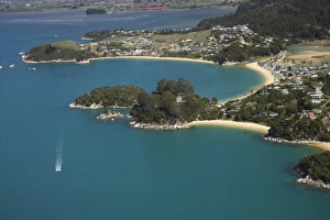
Kaiteriteri (top), Breaker Bay (middle right), Honeymoon Bay (far right), Nelson Region, South Island, New Zealand - aerial
Split Apple Rock, Towers Bay, Kaiteriteri, Nelson Region, South Island, New Zealand - aerial
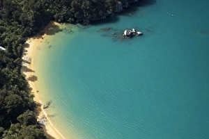
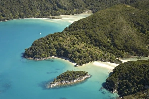
Te Pukatea Bay (front), and The Anchorage, Torrent Bay (back), Abel Tasman National Park, Nelson Region, South Island, New Zealand - aerial
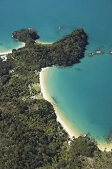
Boundary Bay (bottom) with Holiday Homes, North Head, and Frenchman Bay (top), Abel Tasman National Park, Nelson Region, South Island, New Zealand - aerial
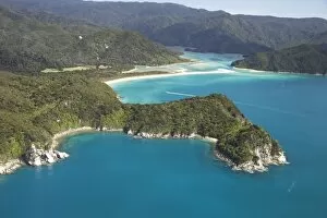
Canoe Bay (front), Awaroa Head, and Awaroa Bay (back), and Awaroa Inlet, Abel Tasman National Park, Nelson Region, South Island, New Zealand - aerial
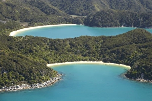
Mosquito Bay (bottom right) and Bark Bay (top left), Abel Tasman National Park, Nelson Region, South Island, New Zealand - aerial
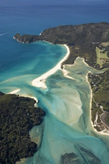
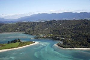
Awaroa Bay, Awaroa Inlet, and Holiday Homes, Abel Tasman National Park, Nelson Region, South Island, New Zealand - aerial
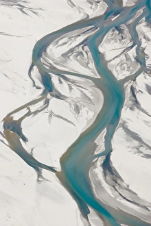
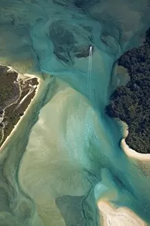
Tidal Patterns, Awaroa Inlet, Abel Tasman National Park, Nelson Region, South Island, New Zealand - aerial
Parapara Inlet and Milnthorpe, Golden Bay, Nelson Region, South Island, New Zealand - aerial
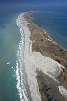
Farewell Spit and Tasman Sea (left), Golden Bay (right), Nelson Region, South Island, New Zealand - aerial
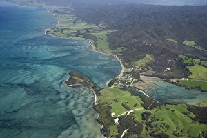
Port Puponga and Golden Bay, Nelson Region, South Island, New Zealand - aerial
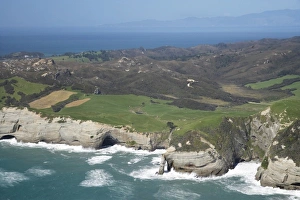
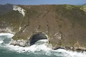
Rugged Coast at Cape Farewell, NW Nelson Region, South Island, New Zealand - aerial
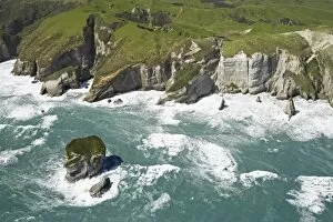
Rugged Coastline near Pilch Point and Wharariki Beach, south of Cape Farewell, NW Nelson Region, South Island, New Zealand - aerial
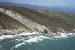
Coast south of Cape Farewell, NW Nelson Region, South Island, New Zealand - aerial
Rock Formations south of Cape Farewell, at Curious Cliff and Mount Lunar by Nguroa Bay NW Nelson Region, South Island, New Zealand - aerial