mail_outline sales@mediastorehouse.com
Norway, Hornindal. View from scenic by-way Road 15 between Geiranger & Hellesylt. Hornindalsvatn lake, Europes deepest lake
North America, Canada, Yukon Territory, Kluane National Park. Saint Elias Mountain RangeCanada, Yukon Territory, Kluane National Park. Saint Elias Mountain Range
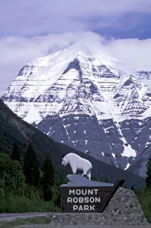
North America, Canada, British Columbia. Mt. Robson towers above the Yellowhead highwayCanada, British Columbia. Mt. Robson towers above the Yellowhead highway
Canada, Alberta, Banff. Views from the summit of Sulphur Mountain
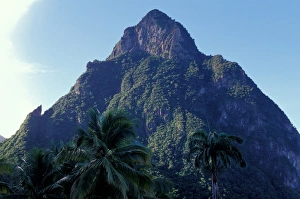
Caribbean, BWI, St. Lucia, Pitons, Anse Chastenet
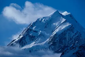
Glacier-clad Mount Cook, the highest mountain in New Zealand rises 12, 349 feet into the sky in the Southern Alps in Mount Cook National Park on the South Island
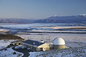
New Zealand, South Island, Canterbury, Mackenzie Country, Telescope Dome, Mt John Observatory, Lake Tekapo
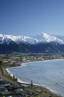
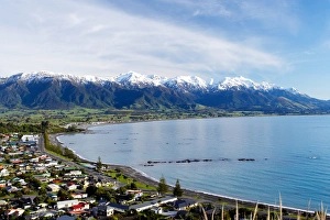
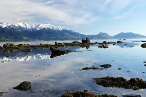
New Zealand, South Island, Kaikoura and Snow on Seaward Kaikoura Range
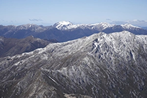
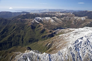
Lead Hills and Clark Peak, Kahurangi National Park, Nelson Region, South Island, New Zealand - aerial
Boulder Lake and Clark Peak (right front), Kahurangi National Park, Nelson Region, South Island, New Zealand - aerial
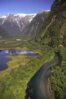
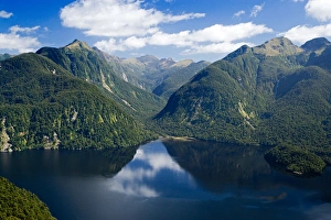
Lake Brown & Arthur River, Arthur Valley, Milford Track, Fiordland National Park - aerialNew Zealand, Lake Brown & Arthur River, Arthur Valley, Milford Track, Fiordland National Park - aerial
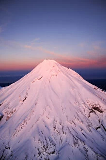
Alpenglow on Summit of Mt Taranaki / Mt Egmont at Dawn, Taranaki, North Island, New Zealand - aerial
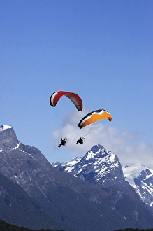
Paramotor and Mt Chaos, Paradise, near Glenorchy, Queenstown Region, South Island, New Zealand
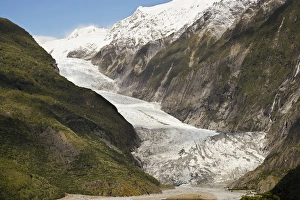
Franz Josef Glacier, Westland National Park, West Coast, South Island, New Zealand
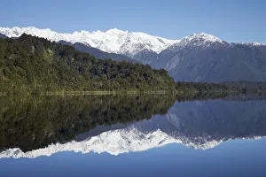
Reflections, Lake Mapourika, West Coast, South Island, New Zealand
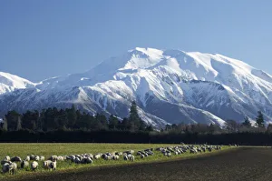
Mount Hutt, Mid Canterbury, South Island, New Zealand
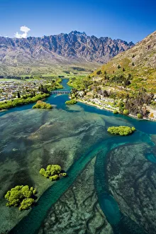
Lake Wakatipu, Kawarau River, and The Remarkables, Queenstown, South Island, New Zealand - aerial
Lake Pukaki and Whale Stream, Ben Ohau Range, Mackenzie Country, South Island, New Zealand - aerial
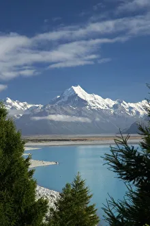
Aoraki / Mt Cook, and Lake Pukaki, Canterbury, South Island, New Zealand
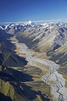
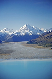
Dobson River and Aoraki / Mt Cook, South Island, New Zealand - aerial
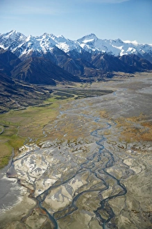
Aoraki / Mt Cook and Tasman River, South Canterbury, South Island, New Zealand - aerial
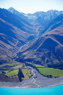
Tasman River and Ben Ohau Range, near Mt Cook, South Canterbury, South Island, New Zealand - aerial
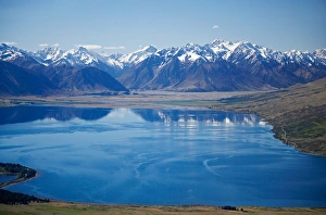
Lake Ohau and Neumann Range (centre and right), Mackenzie Country, South Canterbury, South Island, New Zealand - aerial
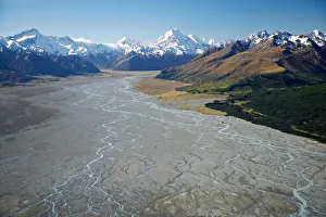
Aoraki / Mt Cook, Lake Pukaki and Tasman River, South Canterbury, South Island, New Zealand - aerial
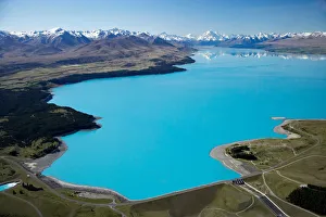
Aoraki / Mt Cook and Lake Pukaki, South Canterbury, South Island, New Zealand - aerial
Bradshaw Sound, Fiordland National Park, South Island, New Zealand - aerial
Kaikoura Township and Seaward Kaikoura Ranges, Marlborough, South Island, New Zealand
Seaward Kaikoura Ranges, Kaikoura, Marlborough, South Island, New Zealand
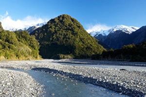
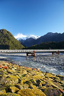
Waiho River, near Franz Josef Glacier, West Coast, South Island, New ZealandBridge and Waiho River, near Franz Josef Glacier, West Coast, South Island, New Zealand
Bridge and Waiho River, near Franz Josef Glacier, West Coast, South Island, New Zealand
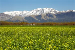
Rapeseed Field and Mountains near Methven, Canterbury, South Island, New Zealand
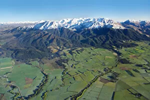
Canterbury Plains and Southern Alps, near Methven, South Island, New Zealand - aerial
Greenland, Igaliku (aka Igaliko). Ruins of Gardar, once the religious heart of 12th c. Norse Greenland. Part of the Eastern Settlement, Bishops complex. Igaliku Fjord in distance
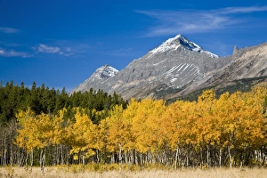
Summit and Little Dog Mountains above peak fall aspen stand near Marias Pass in Glacier National Park in Montana
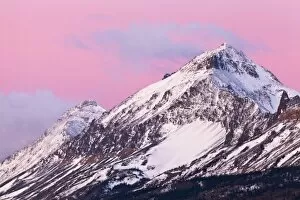
Summit and Little Dog Mountains catch mornings first light at Marias Pass in Glacier National Park, Montana, USA
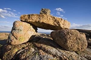
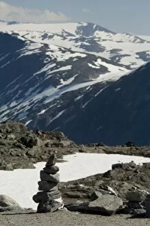
A rock cairn on Cadillac Mountain in Maines Acadia National Park. South Ridge Trail
Norway, Geiranger. Overvew of the port of Geiranger from Mt. Dalsnibba. Scenic road 63 below & cruise ships in harbor
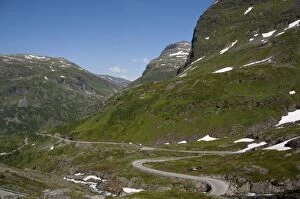
Norway, Geiranger. Scenic byway 63 up to Mount Dalsnibba
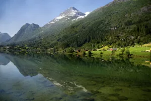
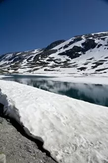
Norway, Scenic area between Geiranger & Hellesylt. Stryn Ski Center, Summer time ski area. Frozen mountain lake
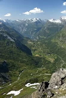
Norway, Geiranger. View from the summit of Mount Dalsnibba
Norway, Geiranger. View of the port of Geiranger from Mt. Dalsnibba. Scenic road 63 and cruise ships in harbor