mail_outline sales@mediastorehouse.com
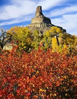
Utah. USA. Squawbush (Rhus trilobata) & cottonwoods (Populus fremontii) in autumn below Gunnison Butte. Green River flood plain
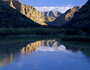
UTAH. USA. Green River at sunrise. Desolation Canyon. Proposed Book Cliffs-Desolation Canyon BLM Wilderness
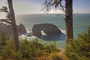
OR, Oregon Coast, Samuel H. Boardman State Scenic Corridor, Natural Bridges
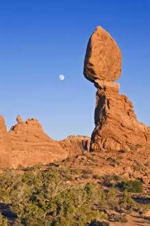
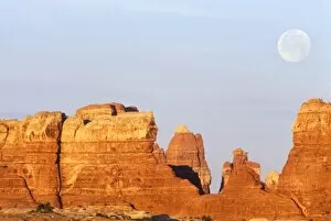
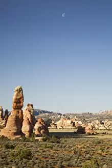
USA, UT, Arches NP, Moon Rising at Balanced rock
USA, Utah, Canyonlands NP, Full Moon Over The Needles
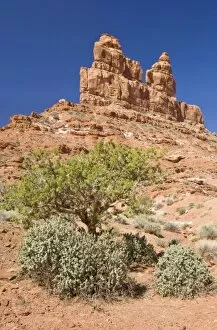
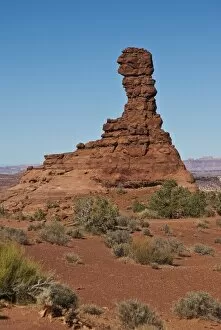
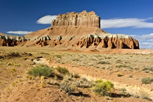
USA, UT, Valley of the Gods, near Mexican Hat RockLNA02420
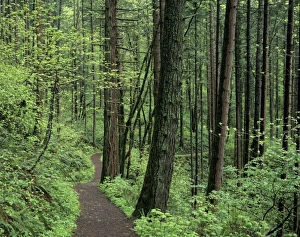
OR, Columbia River Gorge, Mt. Hood NF, trail through forest
Utah, Zion National Park, Boulders and hoodoo
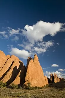
Utah, Arches NP, Fiery Furnace fins
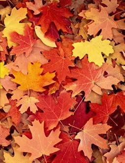
Utah. USA. Fallen leaves of bigtooth maple trees (Acer grandidentatum) in autumn. Blacksmith Fork Canyon. Bear River Range. Uinta-Wasatch-Cache National Forest
Utah, Bryce Canyon NP, Fairyland from Fairyland Loop Trail
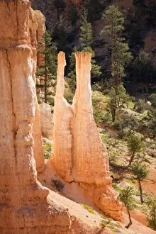
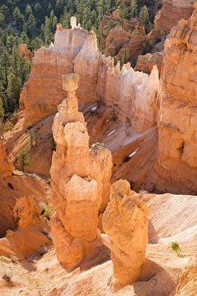
Utah, Bryce Canyon NP, Thors Hammer
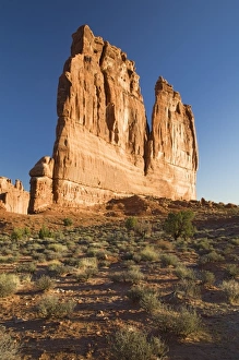
Utah, Canyonlands NP, The Needles, Rock spires at Chesler Park
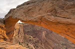
USA, Utah, Canyonlands NP, Mesa Arch at Sunrise
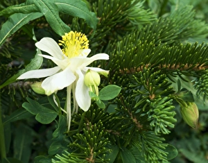
MOUNT NAOMI WILDERNESS, UTAH. USA. Colorado columbine (Aquilegia caerulea) & Engelmann spruce needles (Picea engelmannii). High Creek Canyon. Bear River Range. Wasatch-Cache National Forest
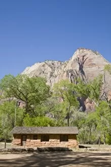
Utah, Zion National Park, Original Visitor Center, Built in 1913, located at The Grotto
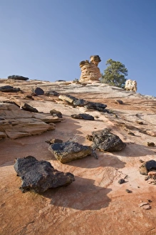
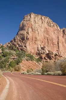
UT, Zion National Park, Kolob Canyons, Navajo sandstone formations
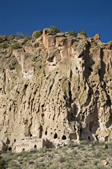
NM, New Mexico, Bandelier National Monument, in Frijoles Canyon, home of Ancestral Pueblo people, canyon wall is a soft rock called tuff, Talus House built in front of clifff dwelling
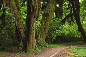
LWOly0411North America, USA, Washington, Olympic National Park. Hall of Mosses in the Hoh River Rainforest
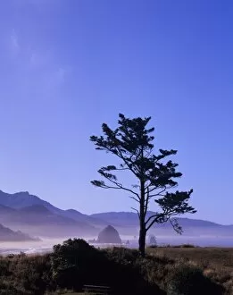
OR, Ecola SP, Seastacks at Cannon Beach, Haystack Rock in background
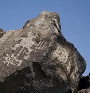
NM, New Mexico, Albuquerque, Petroglyph National Monument, Boca Negra Canyon, petroglyphs tell of ancient human presence
Utah, Arches NP, The Organ
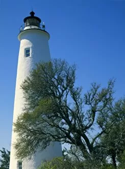
CAPE HATTERAS NATIONAL SEASHORE, NORTH CAROLINA. USA. Lighthouse on Ocracoke Island. Outer Banks
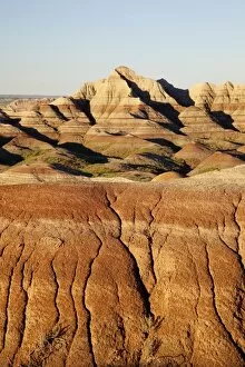
South Dakota, Badlands National Park, Badlands Loop Road
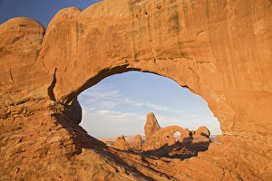
Utah, Arches NP, Turret Arch through North Window
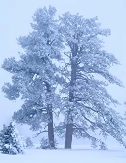
BRYCE CANYON NATIONAL PARK, UTAH. USA. Rime ice-covered ponderosa pines (Pinus ponderosa) in fog. Paunsaugunt Plateau
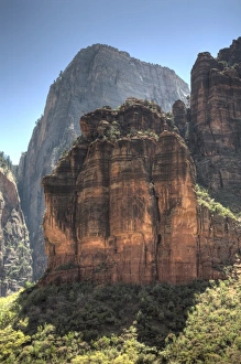
Utah, Zion National Park, rock formation The Organ, the Great White Throne in the background
USA, Utah, Canyonlands NP. Chimney Rock in the Maze Districts Land of Standing Rocks
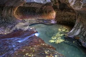
UT, Zion National Park, The Subway, Left Fork of North Creek
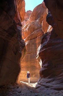
Utah, Paria Canyon-Vermillion Cliffs Wilderness, Buckskin Gulch, 21 mile long slot canyon, Hiker in narrow slot of Buckskin Gulch (MR)
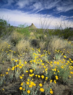
BIG BEND NATIONAL PARK, TEXAS. USA. Desert marigolds (Baileya multiradiata) blooming in early spring amid other desert vegetation. Chihuahuan Desert
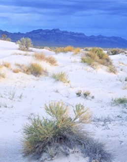
UTAH. USA. Rabbitbrush & sand dunes in Tule Valley. House Range in distance. Proposed Tule Valley BLM Wilderness. Great Basin
USA, Utah, Goblin Valley State Park
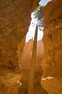
UT, Bryce Canyon National Park, Ponderosa Pine tree with sunburst, at Wall Street on the Navajo Loop trail