mail_outline sales@mediastorehouse.com
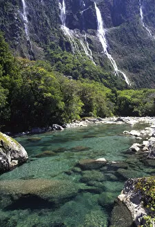
Cleddau River by Milford Road, near Milford Sound, Fiordland National ParkNew Zealand, Cleddau River by Milford Road, near Milford Sound, Fiordland National Park
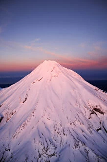
Alpenglow on Summit of Mt Taranaki / Mt Egmont at Dawn, Taranaki, North Island, New Zealand - aerial
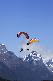
Paramotor and Mt Chaos, Paradise, near Glenorchy, Queenstown Region, South Island, New Zealand
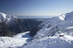
Almer Hut, above Franz Josef Glacier, West Coast, South Island, New Zealand - aerial
Group of Guided Glacier Walkers and Crevasses, Franz Josef Glacier, West Coast, South Island, New Zealand - aerial
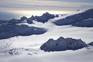
Chamberlin Snowfield and Mackay Rocks, above Franz Josef Glacier, West Coast, South Island, New Zealand - aerial
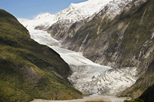
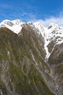
Franz Josef Glacier, West Coast, South Island, New Zealand - aerial
Franz Josef Glacier, Westland National Park, West Coast, South Island, New Zealand
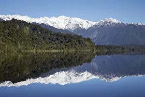
Reflections, Lake Mapourika, West Coast, South Island, New Zealand
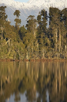
Native Forest Reflected in Lake Mahinapua, near Hokitika, West Coast, South Island, New Zealand
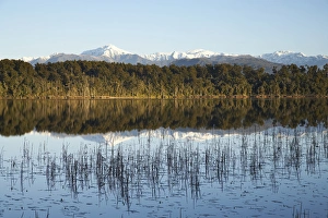
Mt Bowen and Lake Mahinapua, near Hokitika, West Coast, South Island, New Zealand
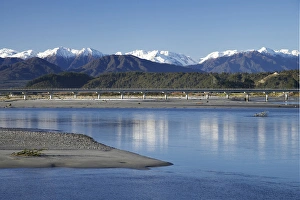
Hokitika River and Southern Alps, West Coast, South Island, New Zealand
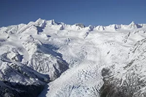
Crevasses, Tasman Glacier, Aoraki / Mt Cook National Park, South Island, New Zealand - aerial
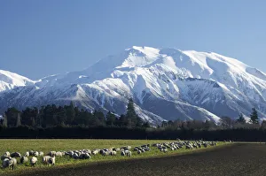
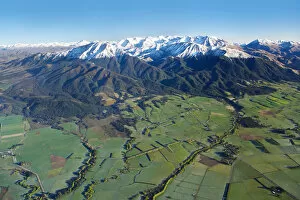
Mount Hutt, Mid Canterbury, South Island, New Zealand
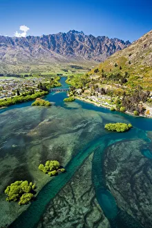
Lake Wakatipu, Kawarau River, and The Remarkables, Queenstown, South Island, New Zealand - aerial
Lake Pukaki and Whale Stream, Ben Ohau Range, Mackenzie Country, South Island, New Zealand - aerial
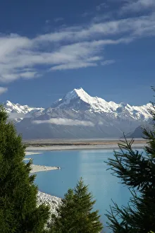
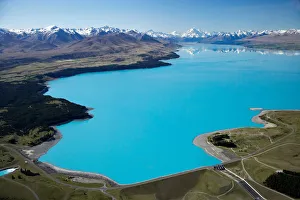
Aoraki / Mt Cook, and Lake Pukaki, Canterbury, South Island, New Zealand
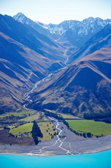
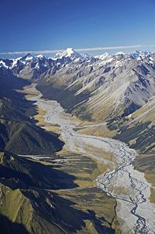
Dobson River and Aoraki / Mt Cook, South Island, New Zealand - aerial
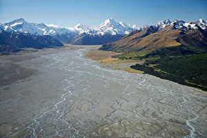
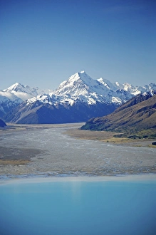
Aoraki / Mt Cook and Tasman River, South Canterbury, South Island, New Zealand - aerial
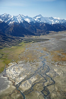
Tasman River and Ben Ohau Range, near Mt Cook, South Canterbury, South Island, New Zealand - aerial
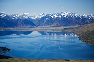
Lake Ohau and Neumann Range (centre and right), Mackenzie Country, South Canterbury, South Island, New Zealand - aerial
Aoraki / Mt Cook, Lake Pukaki and Tasman River, South Canterbury, South Island, New Zealand - aerial
Aoraki / Mt Cook and Lake Pukaki, South Canterbury, South Island, New Zealand - aerial
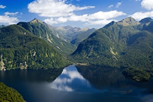
Bradshaw Sound, Fiordland National Park, South Island, New Zealand - aerial
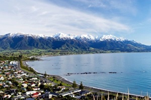
Kaikoura Township and Seaward Kaikoura Ranges, Marlborough, South Island, New Zealand
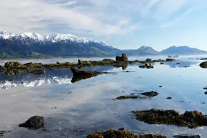
Seaward Kaikoura Ranges, Kaikoura, Marlborough, South Island, New Zealand
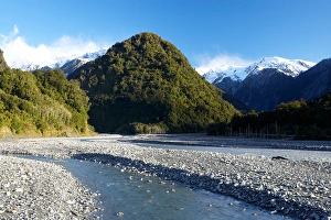
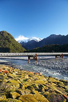
Waiho River, near Franz Josef Glacier, West Coast, South Island, New ZealandBridge and Waiho River, near Franz Josef Glacier, West Coast, South Island, New Zealand
Bridge and Waiho River, near Franz Josef Glacier, West Coast, South Island, New Zealand
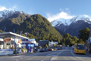
Franz Josef Glacer Township, West Coast, South Island, New Zealand
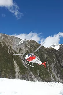
Helicopter, Franz Josef Glacier, West Coast, South Island, New Zealand
Helicopter (in distance), Franz Josef Glacier, West Coast, South Island, New Zealand
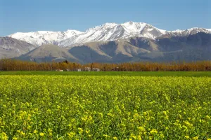
Rapeseed Field and Mountains near Methven, Canterbury, South Island, New Zealand
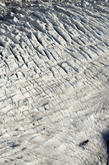
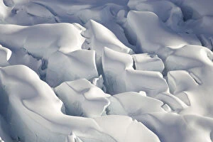
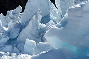
Ice Formations, Franz Josef Glacier, West Coast, South Island, New Zealand
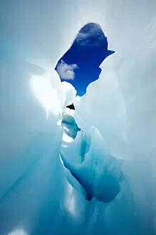
Blue Ice Cave, Franz Josef Glacier, West Coast, South Island, New Zealand
Canterbury Plains and Southern Alps, near Methven, South Island, New Zealand - aerial
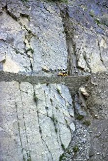
Pakistan, N-W Frontier Province, Hunza Valley. A lone jeep creeps along the narrow road between Gilgit and Hunza in North-West Frontier Province, Pakistan
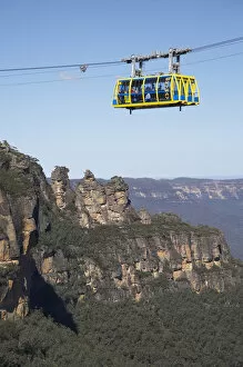
Australia, New South Wales, Blue Mountains, Skyway, KatoombaSkyway, Katoomba, Blue Mountains, New South Wales, Australia
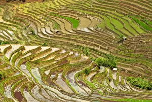
Asia, China, Yunnan, Jinping. Native Yi people plant flooded rice terraces near Laomeng Town
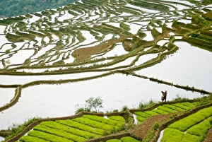
Asia, China, Yunnan Province, Honghe County. Farmer walks by seed rice on flooded Jiayin terraces