mail_outline sales@mediastorehouse.com
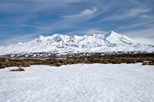
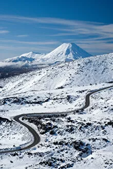
Rangipo Desert and Mt Ruapehu, Central Plateau, North Island, New Zealand
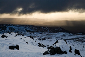
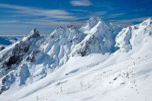
Looking out from Whakapapa Skifield towards National Park, Mt Ruapehu, Central Plateau, North Island, New Zealand
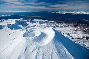
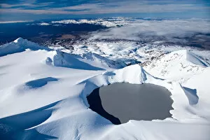
Crater on top of Mt Ngauruhoe, Tongariro National Park, Central Plateau, North Island, New Zealand - aerial
Crater on top of Mt Ngauruhoe, and Mt Ruapehu in distance, Tongariro National Park, Central Plateau, North Island, New Zealand - aerial
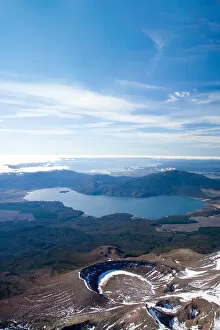
Lower Tama Lake and Mt Ruapehu, Tongariro National Park, Central Plateau, North Island, New Zealand - aerial
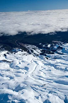
Bruce Road up Mt Ruapehu, and Mt Ngauruhoe, Tongariro National Park, Central Plateau, North Island, New Zealand - aerial
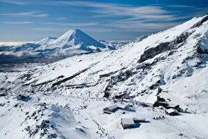
Whakapapa Skifield on Mt Ruapehu, Tongariro National Park, Central Plateau, North Island, New Zealand - aerial
Whakapapa Skifield on Mt Ruapehu, and Mt Ngauruhoe (distance) Tongariro National Park, Central Plateau, North Island, New Zealand - aerial
Sulphur Lagoon Crater on Mt Tongariro, Tongariro National Park, Lake Rotoaira, and Lake Taupo (bottom to top), Central Plateau, North Island, New Zealand, aerial
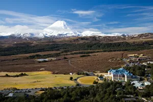
Mt Ngauruhoe and Grand Chateau, Tongariro National Park, Central Plateau, North Island, New Zealand - aerial
Turoa Skifield, Mt Ruapehu, Tongariro National Park, Central Plateau, North Island, New Zealand (and Mt Taranaki / Egmont in distance) - aerial
Lower Tama Lake and Mt Ruapehu (far left in distance), Tongariro National Park, Central Plateau, North Island, New Zealand - aerial
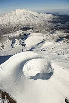
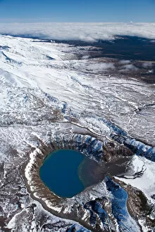
Crater Lake, Mt Ruapehu, Tongariro National Park, Central Plateau, North Island, New Zealand - aerial
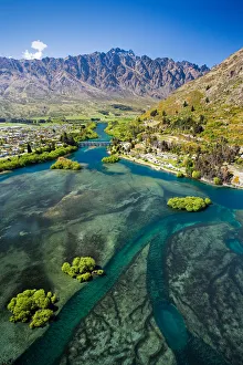
Lake Wakatipu, Kawarau River, and The Remarkables, Queenstown, South Island, New Zealand - aerial
Lake Pukaki and Whale Stream, Ben Ohau Range, Mackenzie Country, South Island, New Zealand - aerial
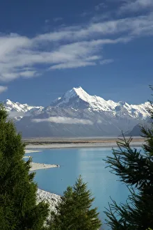
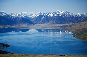
Aoraki / Mt Cook, and Lake Pukaki, Canterbury, South Island, New Zealand
Dobson River and Aoraki / Mt Cook, South Island, New Zealand - aerial
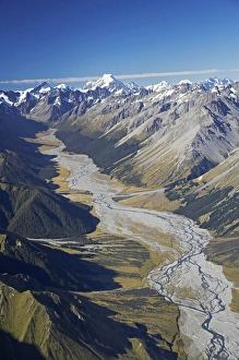
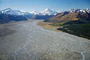
Aoraki / Mt Cook and Tasman River, South Canterbury, South Island, New Zealand - aerial
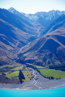
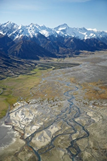
Tasman River and Ben Ohau Range, near Mt Cook, South Canterbury, South Island, New Zealand - aerial
Lake Ohau and Neumann Range (centre and right), Mackenzie Country, South Canterbury, South Island, New Zealand - aerial
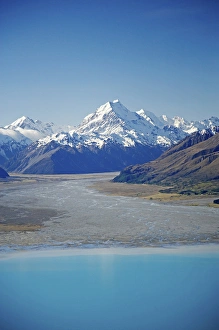
Aoraki / Mt Cook, Lake Pukaki and Tasman River, South Canterbury, South Island, New Zealand - aerial
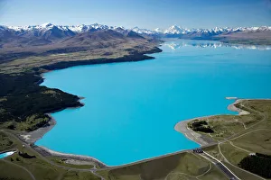
Aoraki / Mt Cook and Lake Pukaki, South Canterbury, South Island, New Zealand - aerial
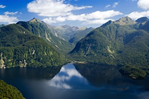
Bradshaw Sound, Fiordland National Park, South Island, New Zealand - aerial
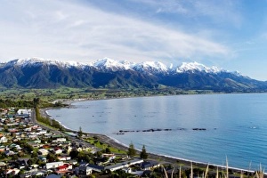
Kaikoura Township and Seaward Kaikoura Ranges, Marlborough, South Island, New Zealand
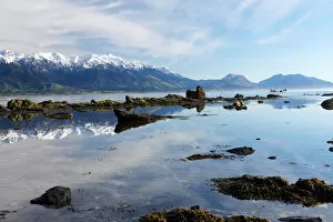
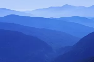
Seaward Kaikoura Ranges, Kaikoura, Marlborough, South Island, New Zealand
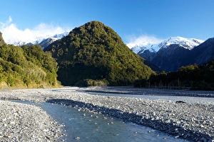
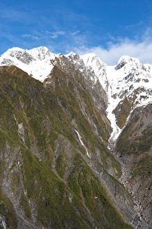
Waiho River, near Franz Josef Glacier, West Coast, South Island, New ZealandBridge and Waiho River, near Franz Josef Glacier, West Coast, South Island, New Zealand
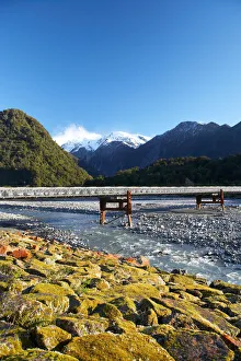
Bridge and Waiho River, near Franz Josef Glacier, West Coast, South Island, New Zealand
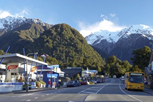
Franz Josef Glacer Township, West Coast, South Island, New Zealand
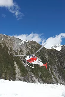
Helicopter, Franz Josef Glacier, West Coast, South Island, New Zealand
Helicopter (in distance), Franz Josef Glacier, West Coast, South Island, New Zealand
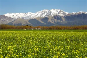
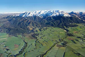
Rapeseed Field and Mountains near Methven, Canterbury, South Island, New Zealand
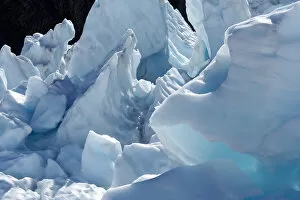
Ice Formations, Franz Josef Glacier, West Coast, South Island, New Zealand
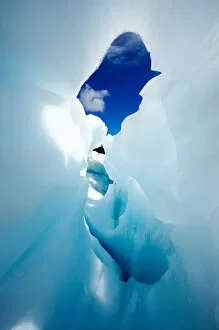
Blue Ice Cave, Franz Josef Glacier, West Coast, South Island, New Zealand
Canterbury Plains and Southern Alps, near Methven, South Island, New Zealand - aerial
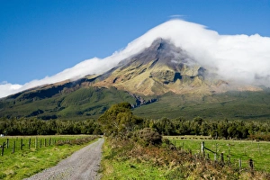
Road and Mt Taranaki / Egmont, Taranaki, North Island, New Zealand
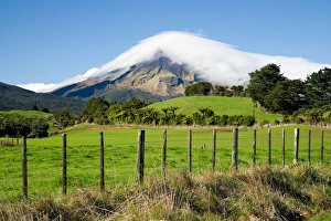
Farmland and Mt Taranaki / Egmont, Taranaki, North Island, New Zealand
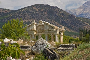
Turkey, Aphrodisius, view of ruins
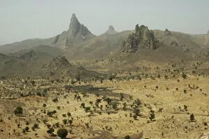
CAMEROON, Rhumsiki. Rocks rising in the middle of an arid landscapeCameroon, Rhumsiki. Rocks rising in the middle of an arid landscape
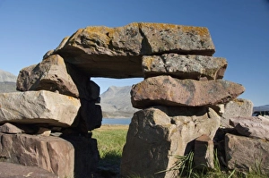
Greenland, Igaliku (aka Igaliko). Ruins of Gardar, once the religious heart of 12th c. Norse Greenland. Part of the Eastern Settlement, Bishops complex. Igaliku Fjord in distance
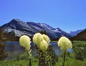
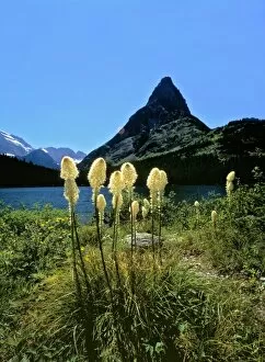
USA, Montana, Glacier NP. Bear grass lines the shore of Swiftcurrent Lake in Glacier National Park, Montana
USA, Montana, Glacier NP. Beargrass sways in the breeze at Swiftcurrent Lake, beneath Grinnell Point in Glacier NP, Montana
USA, MT, Palisade Falls is an easy hike just south of Bozeman, MT
The view to the west from the summit of Old Speck Mountain in Maines Grafton Notch State Park. Mahoosuc Notch is in the foreground. Mount Washington is in the distance
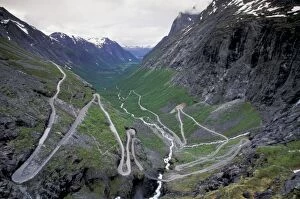
Norway, Trollsteingen, Geiramgerfjord area. Trollstigveg road to Valldal
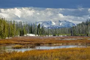
View from southern end of Yellowstone National Park, looking toward Grand Teton National Park, Wyoming
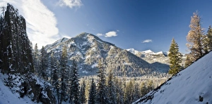
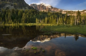
Mineral Mountain and Mount Rainier reflected in Mystic Lake, Mount Rainier National Park, Washington, USA
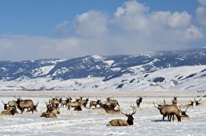
USA, Wyoming, Jackson Hole. National Elk Refuge in winter. Elk, (wild: Cervus elaphus) aka wapiti
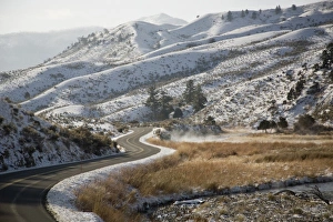
USA, WY, Yellowstone National Park. The main road into the park twists and winds in towards the visitor center, and follows the Yellowstone River