mail_outline sales@mediastorehouse.com
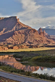
Fisher Towers reflected in Colorado River with Highway below, Utah in evening light
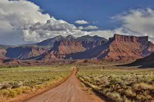
Straight dirt road leading into Professor Valley, Utah
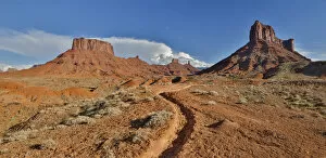
Horse trail leading into Professor Valley, Utah
Photo taken from Long Canyon with badlands and snow capped La Sal Mountains in distance, near Moab, Utah
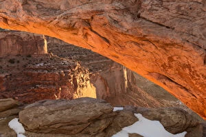
USA Utah Sunrise at Mesa Arch Canyonlands National Park
USA Utah Dead Horse Point Canyonlands National Park Lone Pine
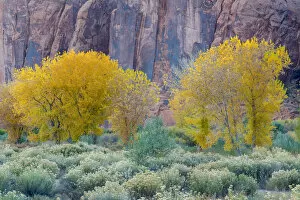
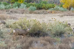
Rabbitbrush outside of Moab, Utah
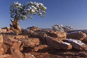
Juniper Tree, Dead Horse Point State Park
Deer outside of Moab, Utah
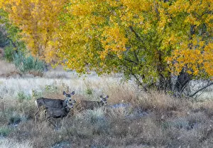
Mother and young Mule deer near Moab Utah
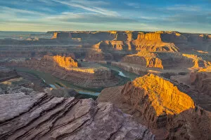
Sunrise at Dead Horse Point State Park, view of Colorado River and Canyonlands National Park
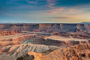
Sunset at Deadhorse Point State Park, view of Colorado river and Canyonlands National Park
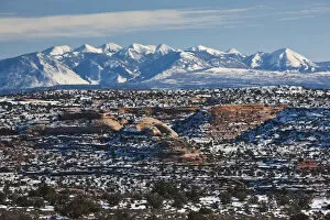
USA, Utah, Moab. Dead Horse Point State Park, view of the La Sal Mountains, winter
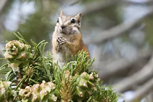
NA, USA, Utah, Moab, Deadhorse SP. Hopi Chipmunk fills cheeks with pinenutsUSA, Utah, Moab, Deadhorse SP. Hopi Chipmunk fills cheeks with pinenuts
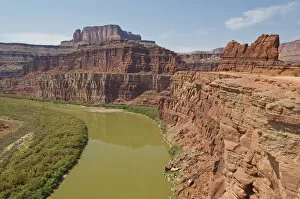
NA, USA, Utah, Moab, Canyonlands NP. Potash Road access into Canyonlands NP providesUSA, Utah, Moab, Canyonlands NP. Potash Road access into Canyonlands NP provides dramatic overlooks of the Colorado River and sandstone cliffs
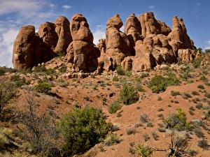
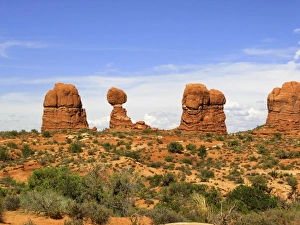
USA, Utah, Arches National Park, Garden of Eden area
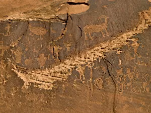
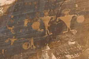
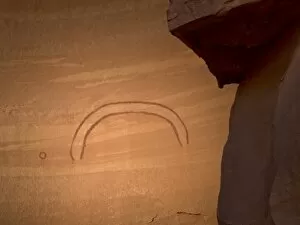
Petroglyphs -- Native American rock art on cliffs along Colorado River near Moab, UT
NA, Utah, MoabUtah, Moab
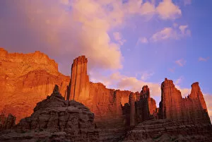
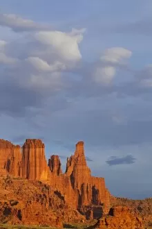
Evening light illuminates the Fisher Towers east of Moab, Utah
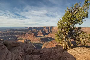
Juniper Tree and Rock, Lasal Mountains in distance, Long Canyon, Blm Land near Moab, UtahJuniper Tree and Rock, Lasal Mountains in distance, Long Canyon, BlM Land near Moab, Utah
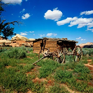
Close-Up of Kirk Cabin and wagon frame located in the Salt Creek Canyon, Needles Area of Canyonlands National Park, Utah
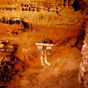
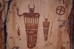
Anasazi Pictograph located in Salt Creek Canyon Canyonlands National Park. One of the few tricolor pictographs that exist
NA, Utah, Moab. Dead Horse State Park, Dead Horse Point overlook and Colorado RiverUtah, Moab. Dead Horse State Park, Dead Horse Point overlook and Colorado River
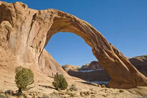
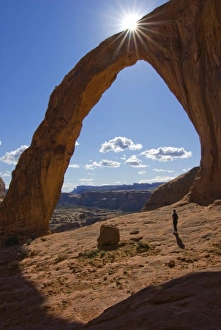
Corona Arch, a freestanding Sandstone Arch on BLm land, Bootlegger Canyon, Southeast, Utah, near Moab, Utah
Colorful rocks and grasses in early morning light by Parrott Mesa near Moab, Utah, USA
The OrganUnited States, State of Utah, Arches National Park. The Organ
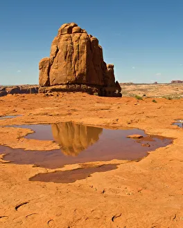
Three Gossips and Courthouse Towers from La Sal mountain viewpoint, Arches National Park
Moon in Wilson Arch on highway 191 between Moab and Monticello Utah adjacent to Needles Area of Canyonlands National Park
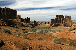
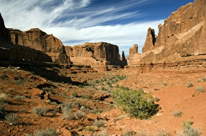
Arches National Park, Utah, Park Avenue
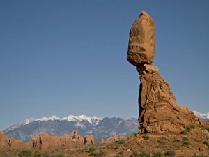
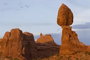
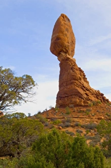
Balanced Rock, Arches National Park, UT
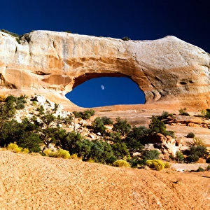
Late light into twilight, Window Arch, Arches National Park, Utah
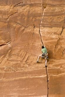
Climbing guide, Moab Desert Adventures in the crux of Miss Kitty likes it that way, on Maverick Buttress, Long Canyon, near Moab, Utah. (MR)
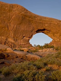
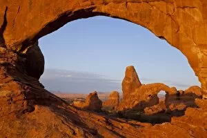
Looking through the North Window onto Turret Arch in Arches National Park, Utah, USA
USA, Utah, Moab, Canyonlands NP. Potash Road access into Canyonlands NP has significant petroglyphs along roadside cliffs
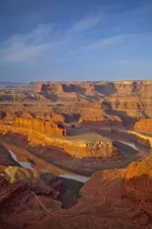
Looking down onto the Colorado River and Canyonlands National Park from Dead Horse State Park near Moab, Utah, USA
Balanced Rock, Arches National Park, near Moab, Utah
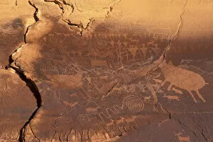
USA, Utah, Moab, Petroglyphs
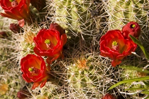
Claret cup cactus
Balanced Rock Arches National Park
United States, State of Utah, Arches National Park. Balanced Rock
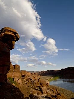
Rock formation along Colorado River flowing through Canyonlands National Park, UT
The Fisher Towers in evening light near Moab, Utah, USA
Rock painting along Colorado River, Canyonlands, Utah
Sunset light and rock fins in north end of Arches National Park, UT, with moon in sky
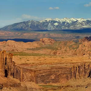
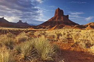
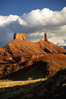
Castle Valley, Utah
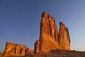
Courthouse Towers in Arches National Park, Utah, USA
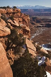
USA, Utah, Moab. Canyonlands National Park, Grand View Overlook, winter
USA, Utah. A female hiker dwarfed by the Corona Arch near Moab. (MR)