mail_outline sales@mediastorehouse.com
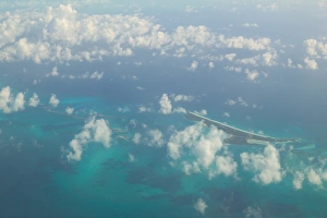
BAHAMAS- Aerial View of the Crooked IslandsBAHAMAS, , Aerial View of the Crooked Islands
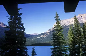
Canada, British Columbia, Yoho NP, Emerald Lake, View From Emerald Lake Lodge
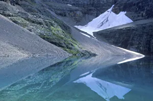
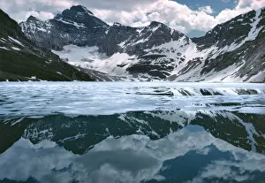
Lake Oesa, Yoho NP, BC, Canada
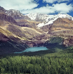
Canada, British Columbia, Lake O Hara. Lake O Hara is one of the jewels of Yoho NP, a World Heritage Site, in British Columbia, Canada
Canada, British Columbia, Lake McArthur. A glacier tarn, Lake McArthur reflects blossoming clouds in its still waters in Yoho NP, a World Heritage Site, British Columbia, Canada
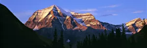
Canada, British Columbia, Mt Robson. The striation on Mount Robson, a World Heritage Site, is accentuated by the sunset light, in British Columbia, Canada
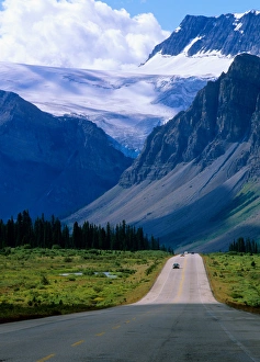
Alberta, Road into the mountains of Banff National Park
Misty mountain peaks at sunrise, Yoho National Park, British Columbia, Canada
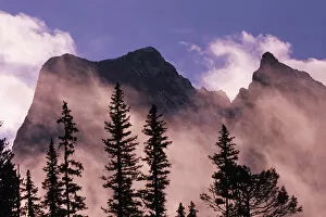
Trees silhouetted against mist and mountains at sunrise, Yoho National Park, British Columbia, Canada
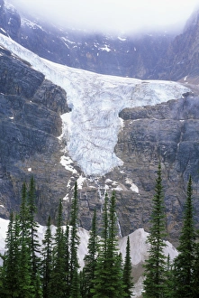
N. A. Canada, Alberta, Jasper NP, Angel GlacierN.A. Canada, Alberta, Jasper NP, Angel Glacier
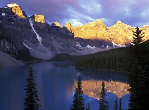
Canada, Alberta, Banff NP, Moraine Lake at First LightLake Moraine at First Light, Banff NP, Alberta, Canada
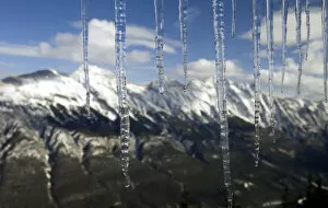
Banff, Alberta, Canada. Icicles and the Rocky Mountains from the top of Sulphur Mountain
Alberta, Canada: Columbia Ice Fields, Jasper National Park
North America, Canada, Alberta, Banff National Park. Landscape around Bow Lake
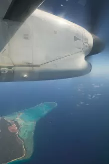
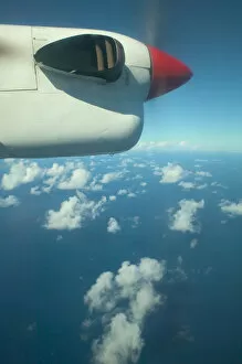
Caribbean, TURKS & CAICOS-Providenciales island- View of Providenciales & PropellerCaribbean, Turks and Caicos, Providenciales Island. View of Providenciales & Propeller
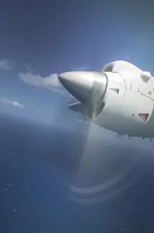
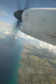
FRENCH WEST INDIES (FWI)-Guadaloupe-Grande-Terre: Propeller Plane above CaribbeanFRENCH WEST INDIES (FWI), Guadaloupe, Grande, Terre: Propeller Plane above Caribbean & Guadaloupe
FRENCH WEST INDIES (FWI)-Guadaloupe-Caribbean: Clouds & Rainbow Colored WaterFRENCH WEST INDIES (FWI), Guadaloupe, Caribbean: Clouds & Rainbow Colored Water from the Air
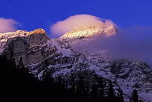
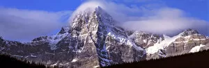
Canada, Alberta, Mt. Chephren. Mount Chephren wears a mantle of clouds in Banff NP, a World Heritage Site, Alberta, Canada
CARIBBEAN Region- Aerial: Propeller Airliner View of Caribbean SeaCARIBBEAN Region, Aerial: Propeller Airliner View of Caribbean Sea
BARBADOS-Caribbean Aerial: Propeller Airliner View over Barbados a WalterBARBADOS, Caribbean Aerial: Propeller Airliner View over Barbados
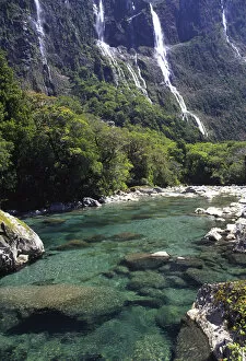
Queenstown, New Zealand. Spectacular lakes, mountaintops, rivers, glaciers, and ice lakes abound as viewed from a Helicopter trip from Queenstown to Milford Sound
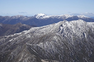
Lead Hills and Clark Peak, Kahurangi National Park, Nelson Region, South Island, New Zealand - aerial
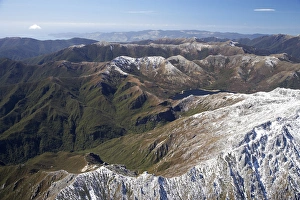
Boulder Lake and Clark Peak (right front), Kahurangi National Park, Nelson Region, South Island, New Zealand - aerial
Cleddau River by Milford Road, near Milford Sound, Fiordland National ParkNew Zealand, Cleddau River by Milford Road, near Milford Sound, Fiordland National Park
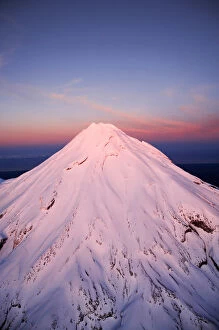
Alpenglow on Summit of Mt Taranaki / Mt Egmont at Dawn, Taranaki, North Island, New Zealand - aerial
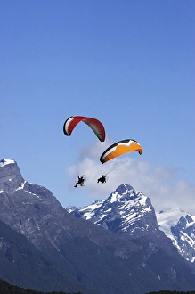
Paramotor and Mt Chaos, Paradise, near Glenorchy, Queenstown Region, South Island, New Zealand
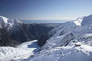
Almer Hut, above Franz Josef Glacier, West Coast, South Island, New Zealand - aerial
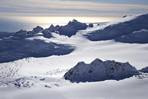
Chamberlin Snowfield and Mackay Rocks, above Franz Josef Glacier, West Coast, South Island, New Zealand - aerial
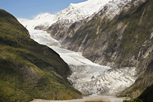
Franz Josef Glacier, Westland National Park, West Coast, South Island, New Zealand
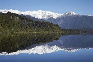
Reflections, Lake Mapourika, West Coast, South Island, New Zealand
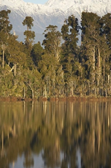
Native Forest Reflected in Lake Mahinapua, near Hokitika, West Coast, South Island, New Zealand
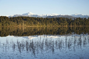
Mt Bowen and Lake Mahinapua, near Hokitika, West Coast, South Island, New Zealand
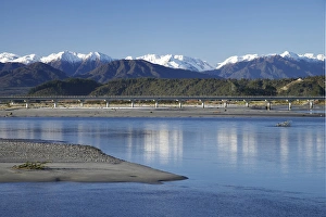
Hokitika River and Southern Alps, West Coast, South Island, New Zealand
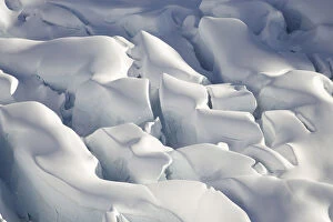
Crevasses, Tasman Glacier, Aoraki / Mt Cook National Park, South Island, New Zealand - aerial
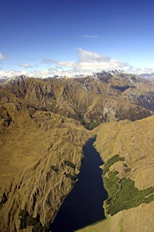
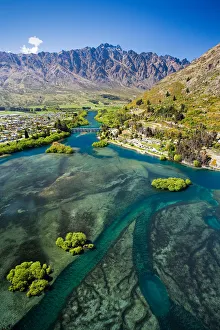
Lake Wakatipu, Kawarau River, and The Remarkables, Queenstown, South Island, New Zealand - aerial
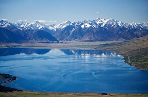
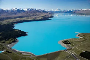
Lake Pukaki and Whale Stream, Ben Ohau Range, Mackenzie Country, South Island, New Zealand - aerial
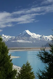
Aoraki / Mt Cook, and Lake Pukaki, Canterbury, South Island, New Zealand
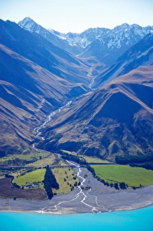
Dobson River and Aoraki / Mt Cook, South Island, New Zealand - aerial
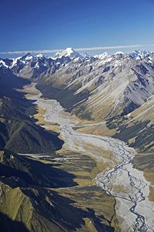
Aoraki / Mt Cook and Tasman River, South Canterbury, South Island, New Zealand - aerial
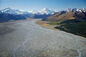
Tasman River and Ben Ohau Range, near Mt Cook, South Canterbury, South Island, New Zealand - aerial
Lake Ohau and Neumann Range (centre and right), Mackenzie Country, South Canterbury, South Island, New Zealand - aerial
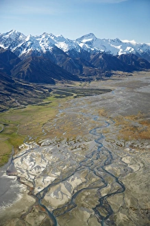
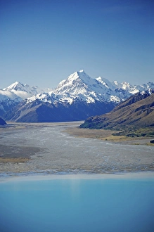
Aoraki / Mt Cook, Lake Pukaki and Tasman River, South Canterbury, South Island, New Zealand - aerial
Aoraki / Mt Cook and Lake Pukaki, South Canterbury, South Island, New Zealand - aerial
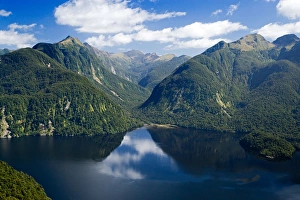
Bradshaw Sound, Fiordland National Park, South Island, New Zealand - aerial
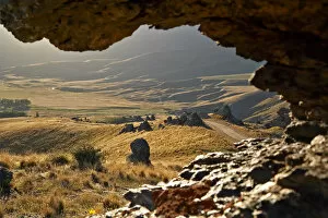
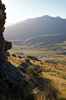
Road to Nevis Valley, Central Otago, South Island, New Zealand
Nevis Valley, Central Otago, South Island, New Zealand
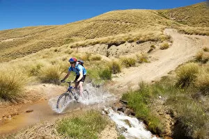
Mountain Bikers, Carrick Track, Carrick Range, Central Otago, South Island, New Zealand
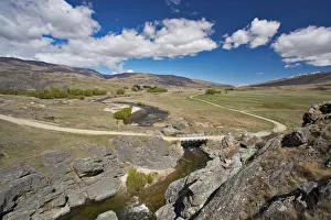
Nevis Crossing, Nevis Valley, Central Otago, South Island, New Zealand