mail_outline sales@mediastorehouse.com
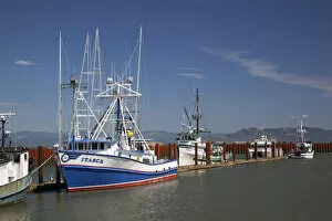
OR, Astoria, East Basin Moorage, Columbia River; Fishing boats
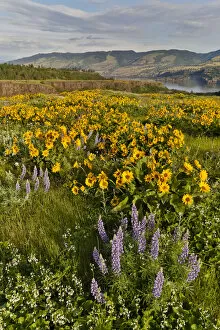
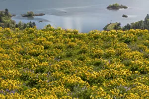
Fields of Balsamroot and Lupine on the Hills above the Columbia River Rowena, Oregon
USA, Oregon. Landscape with Columbia River. Credit as: Don Paulson / Jaynes Gallery / DanitaDelimont
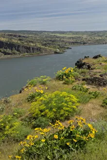
USA, Oregon, Tom McCall Nature Conservancy. Fields of wildflowers and the Columbia River. Credit as: Don Paulson / Jaynes Gallery / DanitaDelimont
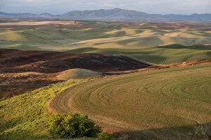
USA: Washington, Columbia River Basin, Snake River Basin, Steptoe Butte views of fields in the Palouse Valley at sunset
Coopey Falls, Columbia River Gorge National Scenic Area, Oregon USA
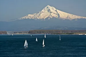
Sailboats, Columbia River, Mount Hood, Portland, Otregon, USA
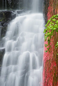
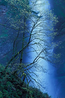
Wahclella Falls, Columbia River Gorge
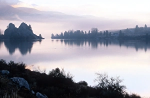
Columbia river; Wahkiakum county, Washington; calm; smooth; dawn; fog; quietDawn on a quiet stretch of the Columbia river in Wahkiakum county
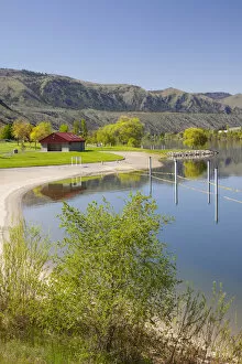
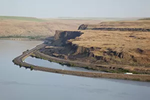
WA, Chelan County, Columbia River along highway 97 at Daroga State Park
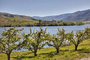
WA, Chelan County, orchard along the Columbia River
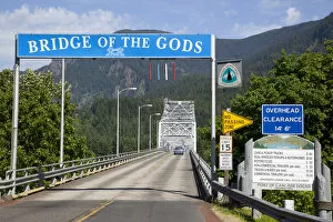
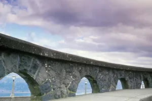
WA, Columbia River Gorge, Bridge of the Gods, crosses the Columbia RiverUSA, Washington, Columbia River Gorge, Bridge of the Gods, crosses the Columbia River
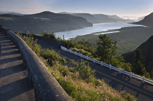
WA, Columbia River Gorge National Scenic Area, Columbia River, and Interstate 84USA, Washington, Columbia River Gorge National Scenic Area, Columbia River, and Interstate 84
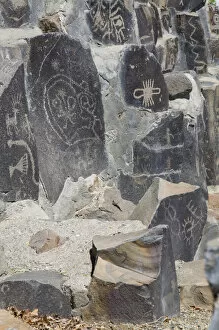
WA, Vantage, Indian Petroglyphs, at the Ginko Petrified Forest Interpretive Center
WA, Vantage, Columbia River, Vantage bridge and Interstate 90 span the Columbia River
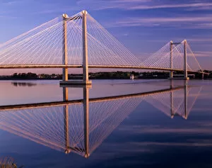
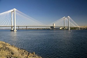
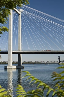
WA, Pasco-Kennewick, Intercity Cable-Stayed Bridge over Columbia River at sunrise
The Ed Hendler Bridge spanning the Columbia River between Pasco and Kennewick, Washington
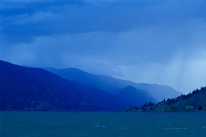
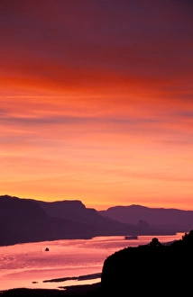
North America; USA; Washington; Oregon; Columbia River Gorge Spring StormNorth America; USA; Washington; Oregon; Columbia River Gorge, Spring Storm
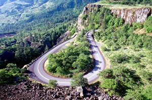
Hairpin turn; twisting; curve; Columbia river highway, Oregon; road; switchbackHairpin curve, Columbia river highway, Oregon
Columbia River, Columbia River Gorge, Oregon, USA
USA, Oregon, Columbia River Gorge National Scenics Area, Latourell Falls viewed throughUSA, Oregon, Columbia River Gorge National Scenic Area, Latourell Falls viewed through forest (Large format sizes available)
An arched stone rock wall frames three light posts overlooking the Columbia River Gorge National Scenic Area at the Vista House Parking lot atop Crown Point. OR, USA
NA, USA, Oregon, Columbia River Gorge, Crownpoint, early June sunrise
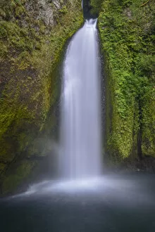
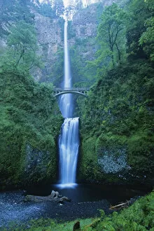
North America; USA; Oregon; Columbia River Gorge Multnomah FallsNorth America; USA; Oregon; Columbia River Gorge, Multnomah Falls
Multnomah Falls, Columbia River Gorge National Scenic Area, OR Multnomah FallsMultnomah Falls, Columbia River Gorge National Scenic Area, OR
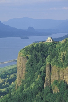
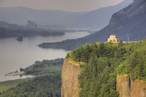
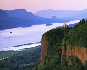
NA, USA, Oregon, Columbia River Gorge NSA View of Vista House from Chanticleer PointUSA, Oregon, Columbia River Gorge NSA. View of Vista House from Chanticleer Point
OR, Columbia River Gorge, Vista House at Crown Point, and the Columbia RiverUSA, Oregon, Columbia River Gorge, Vista House at Crown Point, and the Columbia River
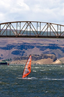
Windsurfing the Columbia River near Biggs, Oregon
USA, Oregon, Crown Point State Park, Columbia River below
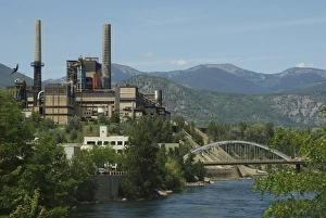
BC: Trail, Columbia River Basin, Teck Cominco Smelting Plant on Columbia River (Editorial Usage Only)
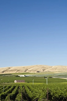
Vineyards of Tri-Cities area in the Columbia Valley, Eastern Washington
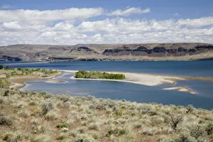
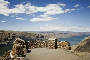
WA, Vantage, Overview of the Columbia River
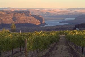
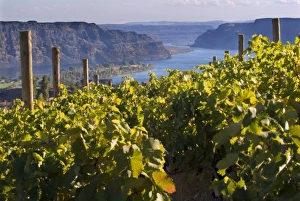
Columbia River seen from Cave B vineyards in Grant County, Washington, USA
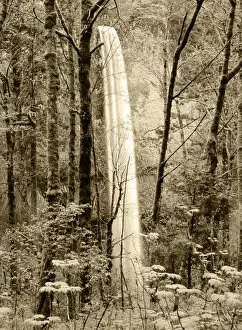
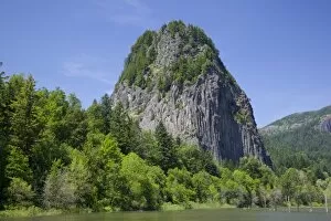
USA, Washington, Columbia River Gorge, Beacon Rock, on the Columbia River; 800 foot shear walled plug of an ancient volcano
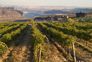
Vineyard and buildings of Cave B Winery and Inn overlooking Columbia River in central Washington, USA
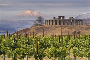
North America, USA, Washington, Maryhill. Oregons snow-capped Mt. Hood seenOregons snow-capped Mt. Hood seen past the Stonehenge replica above the Columbia River near Maryhill, Washington with a vineyard in the foreground
Columbia River seen from White Heron Winery and Vineyards in the Columbia Valley of Washington state
Cable Bridge crossing the Columbia River in Eastern Washington State. Near Kennewick
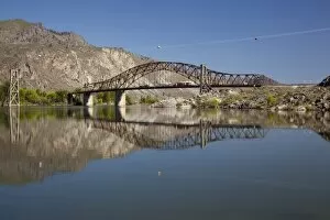
WA, Chelan County, Daroga State Park, Columbia River and bridge