mail_outline sales@mediastorehouse.com
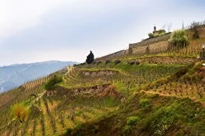
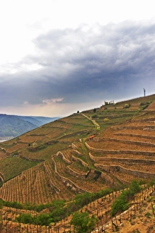
The chapel on top of the hill the Chapelle vineyard. The Hermitage vineyards on theThe chapel on top of the hill the Chapelle vineyard.The Hermitage vineyards on the hill behind the city Tain-laiHermitage. Tain laiHermitage, Drome, France
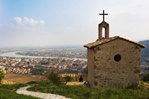
The Hermitage chapel on top of the hill with a view across the river on Tournon. The Hermitage vineyards on the hill behind the city Tain-líHermitage, The twin towns Tain Tournon, Drome, France
The chapel on top of the hill the Chapelle vineyard and lower down the Les Bessards vineyard. The Hermitage vineyards on the hill behind the city Tain-laiHermitage, Drome, France
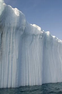
Canada, Baffin island, Striated surface of grounded iceberg, ARCTIC
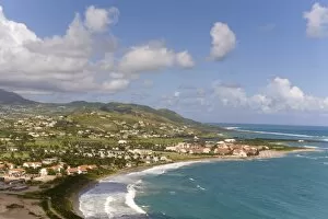
Marriott Resort, southeast peninsula, St Kitts, Caribbean
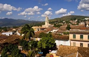
View from above with great clouds of the old Colonial village of Trinidad Cuba buildings
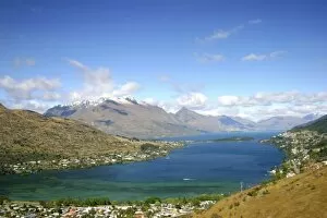
Queenstown, New Zealand. A helicopter ride around Queenstown shows stunning views of the snowcapped mountains, Lake Wakatipu, and the surrounding countryside
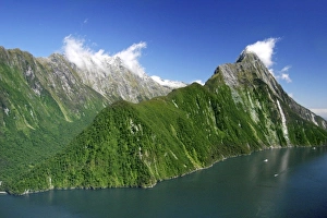
Milford Sound, New Zealand. The majestic fjords, waterfalls, and imposing mountaintops in Milford Sound national park. Mitre Peak in the background is the most famous landmark
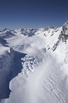
Milford Sound, New Zealand. An aerial journey across the south island into Milford Sound offers plenty of stunning glaciers and snowcovered mountain tops along the way
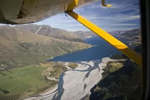
Queenstown, New Zealand. An aerial journey across the south island into Milford Sound. The Shotover River can be seen in the foreground
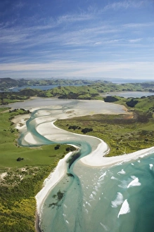
Hoopers Inlet and Allans Beach, Otago Peninsula, Dunedin, South Island, New Zealand - aerial
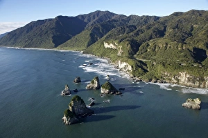
Twelve Mile Bluff and Motukiekie Rocks, north of Greymouth, West Coast, South Island, New Zealand - aerial
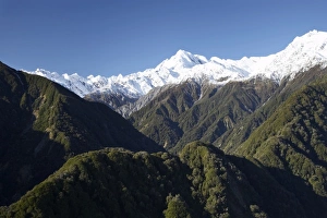
Forest and Southern Alps nesr Franz Josef Glacier, West Coast, South Island, New Zealand - aerial
Forest Burster Range (centre) and Southern Alps nesr Franz Josef Glacier, West Coast, South Island, New Zealand - aerial
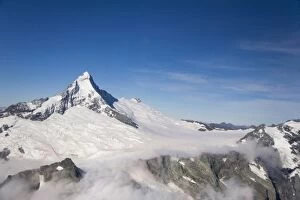
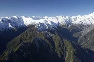
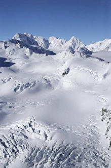
Mt Elie de Beaumont, West Coast, South Island, New Zealand - aerial
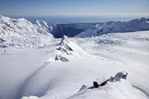
Centennial Hut, above Franz Josef Glacier, West Coast, South Island, New Zealand - aerial
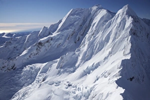
Salisbury Snowfield and Newton Rocks, above Franz Josef Glacier, West Coast, South Island, New Zealand - aerial
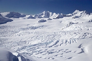
Franz Josef Glacier Neve, West Coast, South Island, New Zealand - aerial
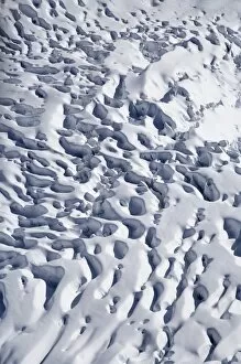
Crevasses, Franz Josef Glacier, West Coast, South Island, New Zealand - aerial
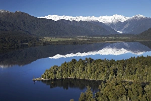
Kayakers, Lake Mapourika, and Southern Alps, West Coast, South Island, New Zealand - aerial
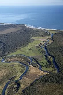
Waitangitaona River, near Whataroa, West Coast, South Island, New Zealand - aerial
Tasman Glacier, Aoraki / Mt Cook National Park, South Island, New Zealand - aerial
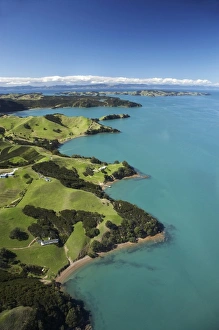
Waiheke Island, Auckland, North Island, New Zealand - Aerial
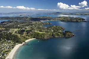
Palm Beach, Waiheke Island, Auckland, North Island, New Zealand - Aerial
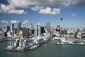
Hilton Hotel, Princes Wharf, Auckland Central Business District and Sky Tower, North Island, New Zealand - Aerial
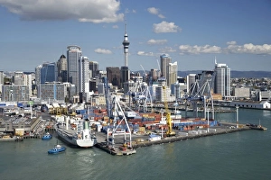
Ports of Auckland, Central Business District and Sky Tower, North Island, New Zealand - Aerial
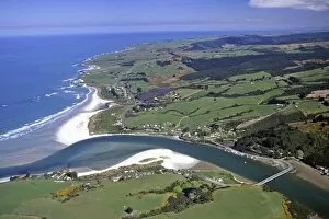
Taieri Mouth, south of Dunedin - aerial
Zambesi River, Zambia
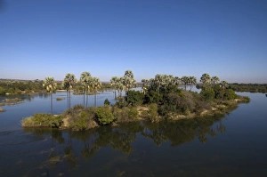
Africa, Zambia, Mosi-Oa-Tunya National Park, Overhead view of palm trees along Zambezi River near Victoria Falls
Kakadu National Park, Northern Territory, Australia - aerial
Magela Falls, Kakadu National Park, Northern Territory, Australia - aerial
Orchard, Kununurra, Kimberley Region, Western Australia, Australia - aerial
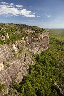
Arnhem Land Escarpment, Kakadu National Park, Northern Territory, Australia - aerial
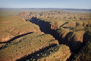
Deep Gorge, Bungle Bungles, Purnululu National Park, Kimberley Region, Western Australia, Australia - aerial
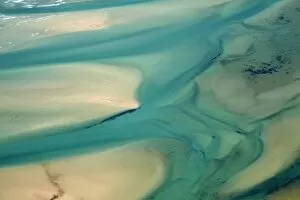
Flow Patterns in Estuary, Sawyer Bay, near Stanley, Northwest Tasmania, Australia - aerial
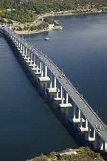
Tasman Bridge, River Derwent, Hobart, Tasmania, Australia - aerial
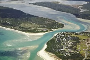
Mouth of Moulting Lagoon, Great Oyster Bay, Freycinet Peninsula, Eastern Tasmania, Australia - aerial
Hazards Beach and Lagoon, Promise Bay, Freycinet National Park, Freycinet Peninsula, Eastern Tasmania, Australia - aerial
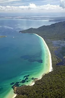
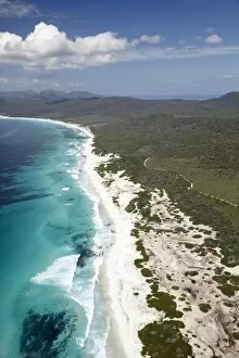
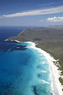
Friendly Beaches, Freycinet National Park, Freycinet Peninsula, Eastern Tasmania, Australia - aerial
Friendly Beaches, and Point Friendly, Freycinet National Park, Freycinet Peninsula, Eastern Tasmania, Australia - aerial
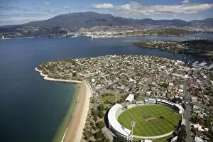
Bellerive Oval, Bellerive, Kangaroo Point Historic Site, River Derwent, Hobart, and Mt Wellington, Tasmania, Australia - aerial