mail_outline sales@mediastorehouse.com
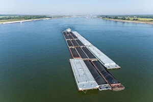
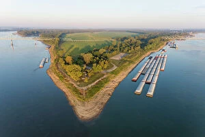
Aerial of barge on the Ohio River near the confluence of the Ohio and Mississippi River, Fort Defiance State Park, Alexander County, Illinois
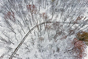
Aerial of forest and road after snowfall, Marion County, Illinois. (Editorial Use Only)
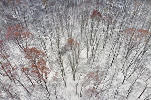
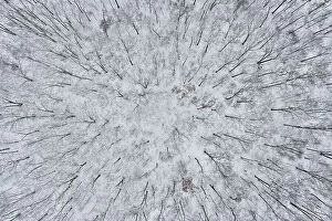
Aerial of forest after snowfall, Marion County, Illinois
Aerial of forest after snowfall, Marion County, Illinois. (Editorial Use Only)
Aerial of the confluence of the Ohio (right) and Mississippi (left) Rivers at the southernmost point in Illinois. Fort Defiance State Park, Alexander County, Illinois. (Editorial Use Only)
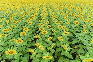
Aerial of a Sunflower field in bloom Jasper County, Illinois
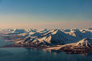
Sunlight highlights ice covered mountains on Spitsbergen Island, Svalbard, Norway
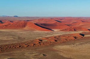
An aerial view of red sand dunes and vegetation in the Namib desert. Namib Naukluft Park, Namibia
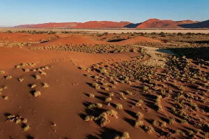
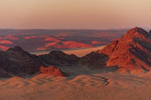
Light illuminates the Naukluft Mountains and Namib Desert at sunrise. Namib Naukluft Park, Namibia
An aerial view of red sand dunes in the Namib desert. Namib Naukluft Park, Namibia
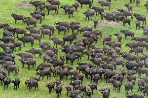
An aerial view of a herd of African buffalo, Syncerus caffer. Okavango Delta, Botswana
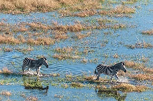
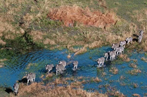
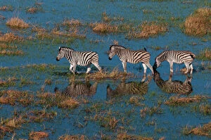
An aerial view of plains zebras, Equus quagga, walking in a flood plain. Okavango Delta, Botswana
Aerial view of plains zebras, Equus quagga, walking in an Okavango Delta flood plain, Botswana
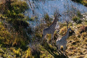
An aerial view of two southern giraffes, Giraffa camelopardalis. Okavango Delta, Botswana
Aerial view of plains zebras, Equus quagga, walking in an Okavango flood plain. Okavango Delta, Botswana
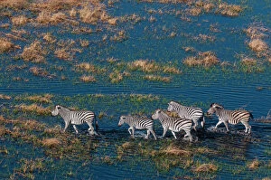
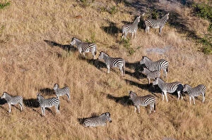
An aerial view of a herd of plains zebras, Equus quagga. Okavango Delta, Botswana
Bridges over Mataura River, Gore, Southland, South Island, New Zealand - drone aerial
Student Flats, Castle Street, North Dunedin, Otago, South Island, New Zealand - aerial
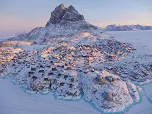
Town Uummannaq during winter in northern West Greenland beyond the Arctic Circle. Greenland, Danish territory
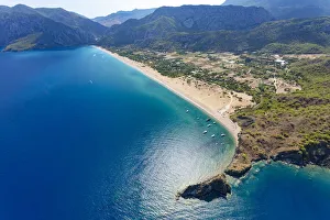
Olympos and Cirali beach aerial, Antalya, Turkey
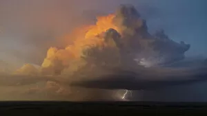
Aerial view of thunderstorm clouds and lightning at sunset, Marion County, Illinois
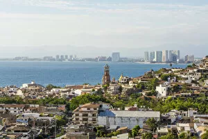
Skyline of Puerto Vallarta, Jalisco, Mexico
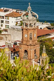
Our Lady of Guadalupe, Puerto Vallarta, Jalisco, Mexico
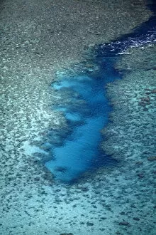
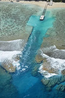
Channel in the reef, Vaimaanga Tapere, Rarotonga, Cook Islands, South Pacific
Channel in the reef, Akaoa Tapere, Rarotonga, Cook Islands, South Pacific
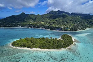
Koromiri Island, Muri Lagoon, Rarotonga, Cook Islands, South Pacific
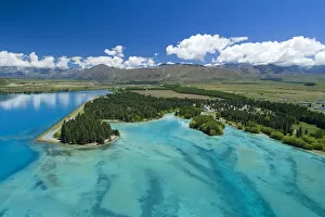
Lake Ruataniwha, Mackenzie Country, South Island, New Zealand
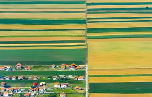
Aerial view of farmland, Belgrade, Serbia
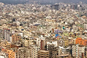
Aerial view of cityscape, Dhaka, Bangladesh
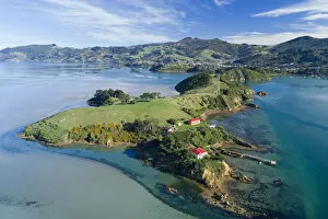
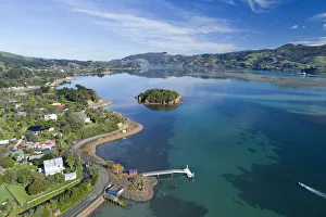
Quarantine Island and Otago Harbour, Dunedin, Otago, South Island, New Zealand
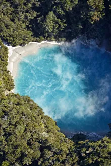
Inferno Crater, Waimangu Volcanic Valley, near Rotorua, North Island, New Zealand
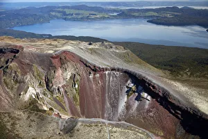
Crater of Mount Tarawera, and Lake Tarawera, near Rotorua, North Island, New Zealand
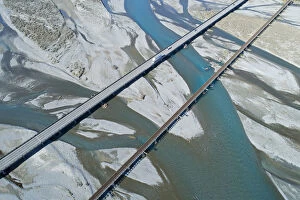
Road and rail bridges across Rakaia River, Rakaia, Mid Canterbury, South Island, New Zealand
Jetty, Portobello, Otago Peninsula, Pudding Island and Otago Harbour, Dunedin, South Island, New Zealand - drone aerial
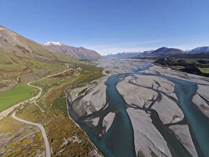
Braids of Rakaia River, near Rakaia, Mid Canterbury, South Island, New Zealand
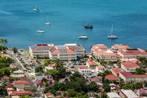
Charlotte Amalie, St. Thomas, US Virgin Islands
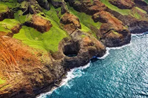
The Bright Eye open ceiling sea cave on the Na Pali Coast, Coast Wilderness State Park, Kauai, Hawaii, USA
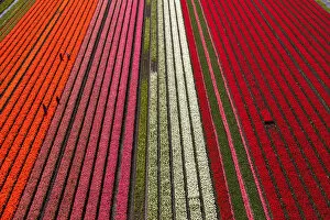
Aerial view of the tulip fields in North Holland, Netherlands
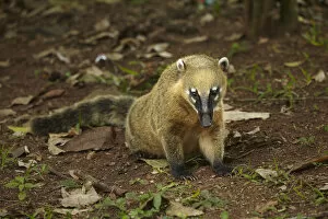
South American coati (Nasua nasua), Iguazu Falls, Argentina
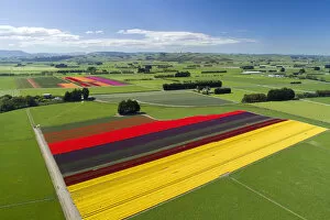
Aerial of colorful tulip fields, Edendale, Southland, South Island, New Zealand
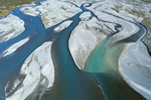
Braided streams of the Rakaia River, Canterbury, South Island, New Zealand, drone aerial
Braided streams of the Rakaia River, and Double Hill Run Road, Canterbury, South Island, New Zealand, drone aerial
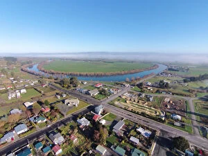
Kaitangata, and Clutha River, near Balclutha, Clutha District, South Otago, South Island, New Zealand - drone aerial
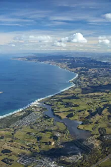
Kaikorai Lagoon and Waldronville, Dunedin, Otago, South Island, New Zealand - aerial
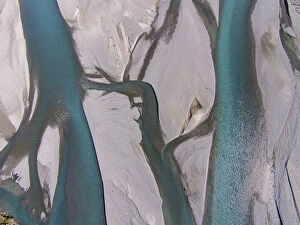
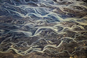
Aerial of braided rivers, Iceland
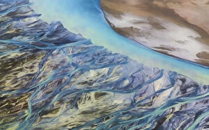
Canada, Yukon, Kluane National Park. Abstract aerial of mountains and Slims River. Credit as: Don Paulson / Jaynes Gallery / DanitaDelimont
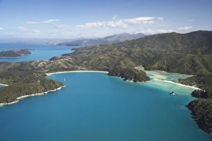
The Anchorage (left) and Torrent Bay (right), Abel Tasman National Park, Nelson Region, South Island, New Zealand - aerial