mail_outline sales@mediastorehouse.com
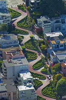
USA, California, San Francisco - Lombard Street (claimed to be the worlds crookedest street)USA, California, San Francisco - Lombard Street (claimed to be the worldas crookedest street), Russian Hill neighborhood - aerial
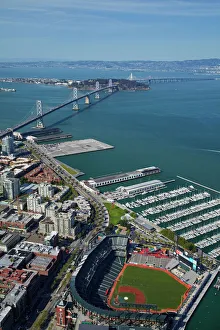
USA, California, San Francisco - AT&T Park / Giants Ballpark (home of San Francisco Giants baseball team), South Beach Marina, downtown San Francisco, and Bay Bridge - aerial
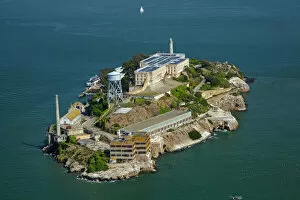
USA, California, San Francisco - Alcatraz Island, former maximum high-security federal prison, San Francisco Bay - aerial
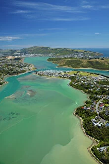
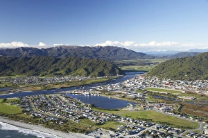
Pauatahanui Inlet, Porirua Harbour, Wellington Region, North Island, New Zealand - aerial
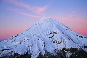
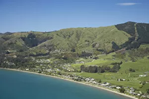
Summit of Mt Taranaki / Mt Egmont at Dawn, Taranaki, North Island, New Zealand - aerial
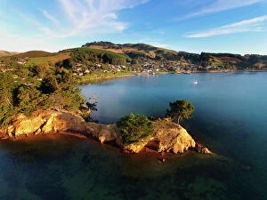
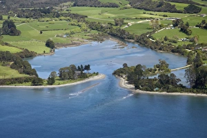
Yellow Point, Broad Bay and Otago Peninsula, Dunedin, South Island, New Zealand - drone aerial
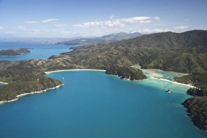
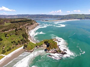
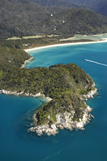
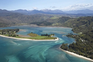
The Anchorage (left) and Torrent Bay (right), Abel Tasman National Park, Nelson Region, South Island, New Zealand - aerial
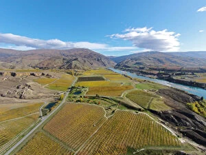
Vineyards, Felton Road, Bannockburn, and Kawarau Arm, Lake Dunstan, near Cromwell, Central Otago, South Island, New Zealand - drone aerial
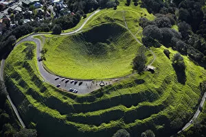
Volcanic crater, Mt Eden, ( historic Maori pa site ), Auckland, North Island, New Zealand - aerial
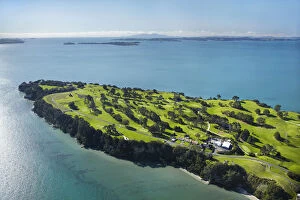
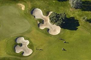
Howick Golf Course, Auckland, North Island, New Zealand - aerial
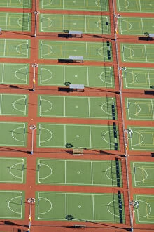
Netball Courts, Auckland Netball Centre, Mount Wellington, Auckland, North Island, New Zealand - aerial
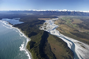
Whataroa River and Southern Alps, West Coast, South Island, New Zealand - aerial
Greymouth, West Coast, South Island, New Zealand - aerial
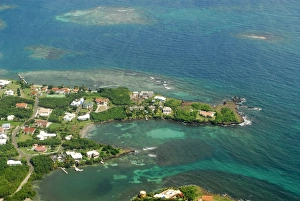
Grenada, aerial view of city of St George and beach
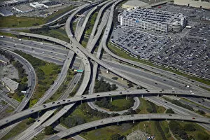
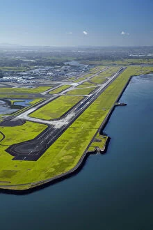
USA, California, San Francisco - Interchange of 1-380 and Bayshore Freeway (US 101) near San Francisco International Airport - aerial
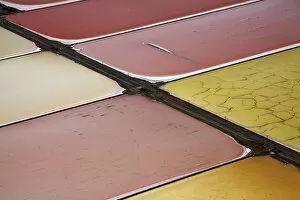
USA, California, San Francisco - Colourful algae in salt evaporation ponds, Redwood City, San Francisco Bay - aerial
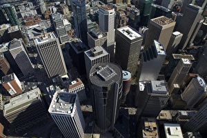
USA, California, San Francisco - Looking down onto skyscrapers, Market Street, in the financial district, downtown San Francisco - aerial
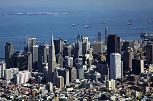
USA, California, San Francisco - Downtown San Francisco, and ships in San Francisco Bay - aerial
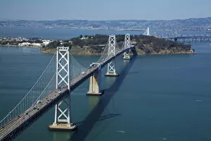
USA, California, San Francisco - San Franciscoaa'Oakland Bay Bridge (Bay Bridge)USA, California, San Francisco - San Franciscoa'Oakland Bay Bridge (Bay Bridge), crossing San Francisco Bay to Yerba Buena Island - aerial
USA, California, San Francisco - Municipal Pier and San Francisco Maritime National Historical Park - aerial
Runway at Auckland Airport, and Manukau Harbour, North Island, New Zealand - aerial
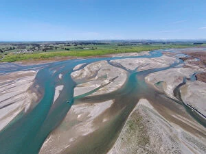
Waitaki River near coast, North Otago / South Canterbury border, South Island, New Zealand - drone aerial
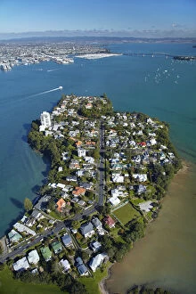
Stanley Point, Waitemata Harbour, and Auckland Harbour Bridge, Auckland, North Island, New Zealand - aerial
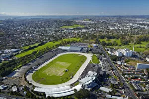
Alexandra Park Raceway, and Greenlane Clinical Centre, Auckland, North Island, New Zealand - aerial
Remuera Golf Course, Auckland, North Island, New Zealand - aerial
Rental cars, Auckland Airport, North Island, New Zealand - aerial
Mapoutahi, Historic Maori Pa Site, Goat Island, Purakanui Bay, north of Dunedin, South Island, New Zealand - drone aerial
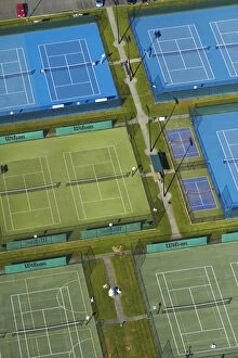
Tennis courts, Albany, Auckland, North Island, New Zealand - aerial
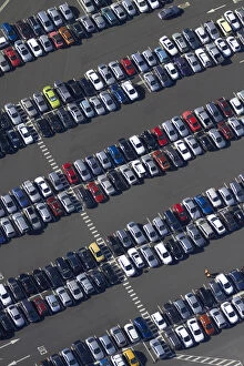
Car park, Auckland Airport, North Island, New Zealand - aerial
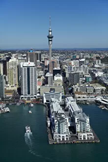
Hilton Hotel, Sky Tower, and Auckland waterfront, Auckland, North Island, New Zealand - aerial
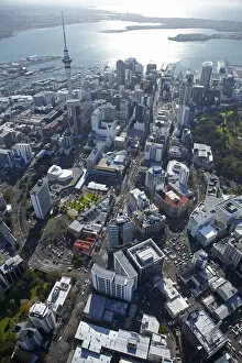
Queen Street, Sky Tower and Central Business District, Auckland, North Island, New Zealand - aerial
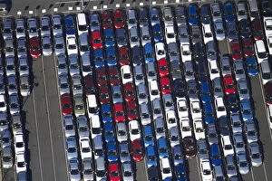
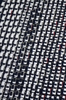
Newly imported vehicles at Ports of Auckland, Auckland, North Island, New Zealand - aerial
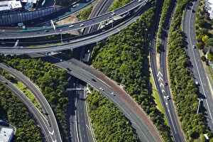
Spaghetti Junction (officially Central Motorway Junction), Newton, Auckland, North Island, New Zealand - aerial
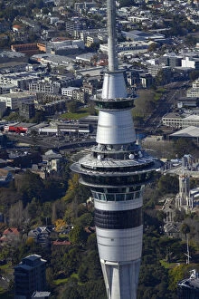
Sky Tower, Auckland, North Island, New Zealand - aerial
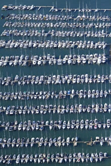
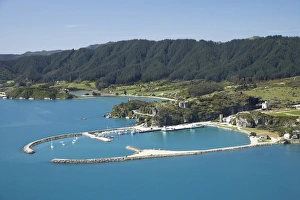
Westhaven Marina, Auckland, North Island, New Zealand - aerial
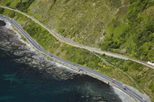
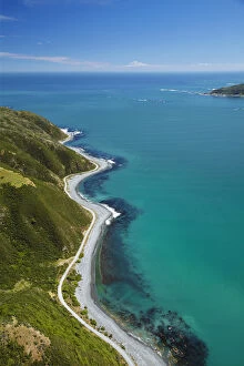
State Highway One and North Island Main Trunk Railway, between Paekakariki and Pukerua Bay, Wellington, North Island, New Zealand - aerial
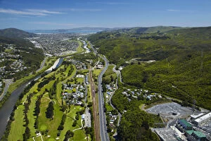
Hutt River, Manor Park Golf Course and State Highway Two, Lower Hutt, Wellington, North Island, New Zealand - aerial
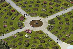
Lady Norwood Rose Garden, Wellington Botanic Garden, Wellington, North Island, New Zealand - aerial
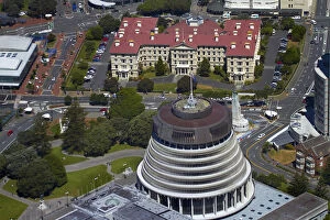
The Beehive, Parliament Grounds, and Old Government Buildings, Wellington, North Island, New Zealand - aerial
Shoreline near Eastbourne, and entrance to Wellington Harbour, Wellington, North Island, New Zealand - aerial
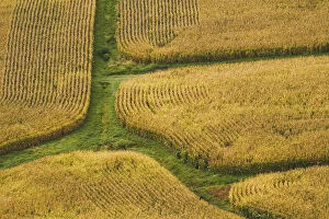
Farm crops, Rukuhia, near Hamilton, Waikato, North Island, New Zealand - aerial
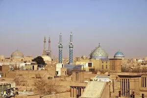
Iran, Yazd, Aerial View of the city with its mosques, domes, minarets and windtowers
Canoe Bay, Awaroa Head, Awaroa Bay, Abel Tasman National Park, Nelson Region, South Island, New Zealand - aerial
Pohara, near Takaka, Golden Bay, Nelson Region, South Island, New Zealand - aerial
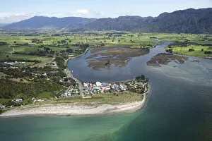
Tarakohe, Golden Bay, Nelson Region, South Island, New Zealand - aerial
Inlet, Onekaka, Golden Bay, Nelson Region, South Island, New Zealand - aerial
Collingwood and Aorere River Estuary, Golden Bay, Nelson Region, South Island, New Zealand - aerial
Parapara (left), Parapara Inlet and Milnthorpe (right), Golden Bay, Nelson Region, South Island, New Zealand - aerial